
Hiking Þórsmörk: The Ultimate Volcano Trekking Guide to Iceland’s Volcanic Valley
Þórsmörk, or the Valley of Thor, is a stunning volcanic valley nestled between glaciers in South Iceland. This guide covers the unique geology, challenging terrain, trekking routes, logistics, and accommodation options for an unforgettable hiking experience in one of Iceland’s most iconic nature reserves.
Quick Volcano Snapshot
| Attribute | Value |
|---|---|
| Volcano type | Volcanic valley |
| Elevation | Approx. 1000 m (max elevation varies by trail) |
| Location | South Iceland, Iceland |
| Activity status | Dormant |
| Trekking difficulty | Moderate |
| Typical trek duration | 3-5 days (Laugavegur Trail segment) |
| Altitude gain | Up to 1000 m on some routes |
| Terrain type | Volcanic ash slopes, lava fields, birch forests, glacier rivers, rocky ridges |
| Best season | June to September |
| Temperature range | 5°C to 15°C in summer |
| Permit requirement | No special permits required; access regulated seasonally |
The Experience of Hiking Þórsmörk
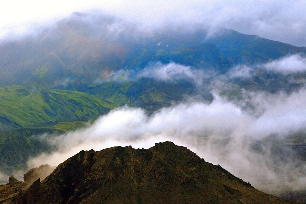
Approaching Þórsmörk, hikers are greeted by a dramatic landscape where volcanic forces and glaciers converge. The valley’s lush birch forests and moss-covered slopes contrast vividly with the stark black sands and jagged volcanic ridges. Trekking here is a journey through a living geological canvas, where the power of Iceland’s volcanic heart is palpable. Each step reveals sweeping views of glaciers and rivers carved by ancient ice and fire, culminating in the emotional thrill of standing amidst a valley shaped by myth and eruption.
Geological Background of Þórsmörk
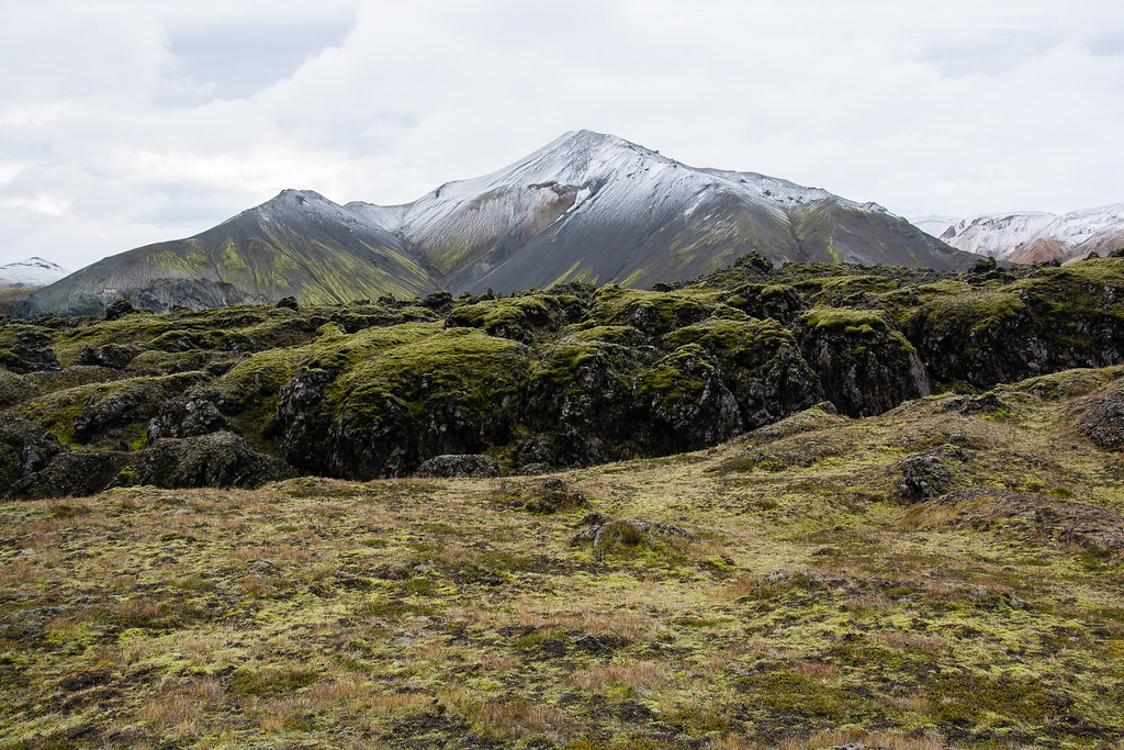
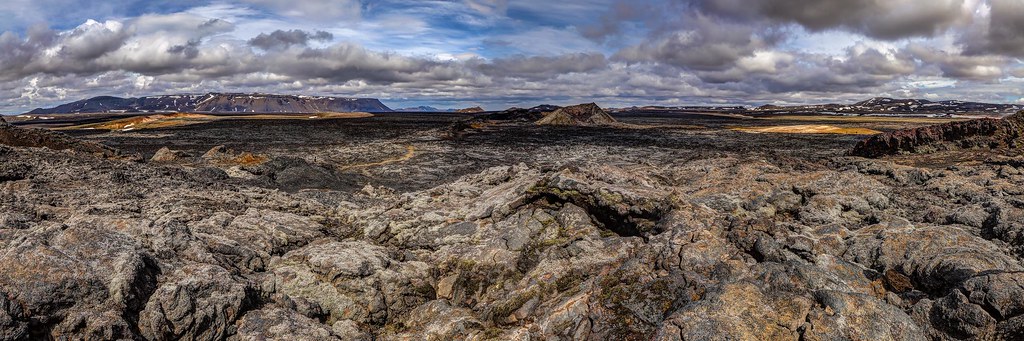
Þórsmörk is a volcanic valley formed by the interplay of volcanic activity and glacial sculpting. Nestled between three glaciers—Eyjafjallajökull, Mýrdalsjökull, and Tindfjallajökull—it is shaped by volcanic eruptions and glacial floods. The 2010 eruption of Eyjafjallajökull notably altered the landscape, creating new craters named Magni and Móði after Thor’s sons in Norse mythology. The valley’s terrain includes volcanic ash fields, lava flows, and rugged ridges, interspersed with birch forests and mossy slopes. Fumaroles and steam vents are less prominent here than in geothermal areas but the volcanic legacy is evident in the dramatic topography and fertile soils supporting diverse vegetation.
Terrain and Hiking Experience in Þórsmörk
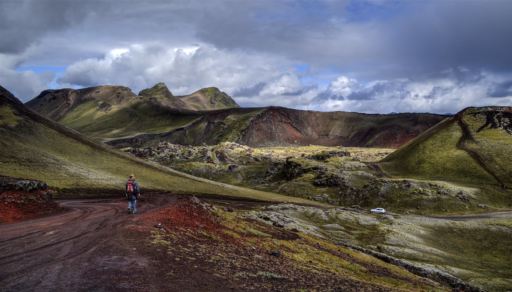
Hiking in Þórsmörk offers a diverse and immersive experience through volcanic and glacial landscapes. The terrain varies from soft moss-covered slopes and dense birch forests to rugged volcanic ridges and black sand riverbeds. Trails often involve crossing glacier-fed rivers, which can be swift and cold, requiring careful navigation or use of established bridges. The volcanic ash and lava fields present loose, uneven footing, demanding sturdy hiking boots and good balance. Elevation gains can be moderate to steep, especially on routes like the Fimmvörðuháls Pass, which ascends approximately 700-800 meters over rough volcanic terrain. Weather conditions can shift rapidly, with strong winds and temperature fluctuations common, so hikers must be prepared for variable conditions. The trail surfaces range from packed dirt and gravel to rocky scree and volcanic sand, influencing hiking speed and effort. Despite these challenges, the trails are well-marked and maintained during the summer season, with huts and campsites providing rest points. The hiking experience is enriched by panoramic views of glaciers, volcanic craters, and lush valleys, making the physical demands worthwhile for the stunning natural beauty encountered at every turn.
What Makes Þórsmörk Trek Unique
Þórsmörk’s uniqueness lies in its dramatic convergence of volcanic and glacial landscapes within a verdant valley. Unlike many volcanic treks dominated by barren rock, Þórsmörk combines lush birch forests and mossy fields with stark volcanic ridges and craters formed by recent eruptions. The proximity to glaciers like Eyjafjallajökull adds a dynamic element, with glacial rivers and ice-capped peaks framing the valley. The presence of the Magni and Móði craters, born from the 2010 eruption, offers hikers a rare chance to witness fresh volcanic features. The valley’s mythological connection to Thor enriches the cultural experience, while the diverse ecosystems—from arctic flowers to Arctic fox habitats—add natural intrigue. The trek’s accessibility via the famous Laugavegur Trail and the challenging Fimmvörðuháls Pass further enhance its appeal for adventure seekers and geology enthusiasts alike.
Summit and Crater Experience in Þórsmörk
Reaching the summits and craters around Þórsmörk, such as those on the Fimmvörðuháls Pass, rewards hikers with breathtaking panoramas of volcanic landscapes and glacier vistas. The craters Magni and Móði, formed in 2010, showcase fresh lava flows and cooling volcanic rock, offering a tangible connection to Iceland’s fiery geology. The air carries a faint scent of sulfur, and the ground beneath may still emit residual warmth in places. From these vantage points, hikers can observe the vastness of the surrounding glaciers and the intricate river networks below. The sense of standing on recently forged volcanic terrain evokes awe and respect for the Earth’s power, making the summit experience both dramatic and deeply memorable.

Best Time to Trek Þórsmörk
The optimal trekking season in Þórsmörk spans from June to September, when trails are mostly free of snow and weather conditions are relatively stable. Summer temperatures range from 5°C to 15°C, though sudden changes and strong winds are common. The valley’s access roads and river crossings are only passable during this period, as winter snows close the rugged F-roads and make the area inaccessible to most vehicles. Early summer offers lush greenery and blooming arctic flowers, while late summer provides longer daylight hours and clearer skies. Trekkers should avoid shoulder seasons due to unpredictable weather and potential trail closures. Monitoring local volcanic activity and weather forecasts is essential, as eruptions or floods can impact safety and access.
Routes and Trail Options in Þórsmörk
Þórsmörk serves as a key junction for several renowned hiking routes. The Laugavegur Trail, Iceland’s most famous multi-day trek, ends or begins here, stretching approximately 55 kilometers from Landmannalaugar to Þórsmörk over 3 to 5 days. This route traverses diverse landscapes, including rhyolite mountains, lava fields, and glacier valleys. For those seeking a challenging extension, the Fimmvörðuháls Trail continues from Þórsmörk to Skógar, covering about 30 kilometers and ascending 700-800 meters. This trail passes the Magni and Móði craters and offers spectacular volcanic and glacial views. Shorter day hikes within Þórsmörk include the Tindfjallahringur Loop (8-12 km), Hvannárgil Canyon (6-8 km), and Hestagötur Trail (9 km), each showcasing different aspects of the valley’s terrain and scenery. Guided and self-guided options are available, with well-marked trails and huts or campsites along the way. Access to Þórsmörk is typically via 4×4 vehicles or scheduled highland buses due to river crossings on the F249 road.
Difficulty Assessment of Þórsmörk Treks
Þórsmörk treks are generally classified as moderate, suitable for hikers with a good level of fitness and some experience in uneven terrain. Trails involve variable surfaces including loose volcanic ash, rocky paths, and river crossings that require caution. Elevation gains can reach up to 1000 meters on routes like Fimmvörðuháls, demanding stamina and endurance. Weather conditions such as wind and sudden temperature drops add to the challenge. While technical climbing is not required, hikers should be prepared for steep ascents and descents, and the physical demands of multi-day trekking with a backpack. Beginners may prefer guided tours or shorter day hikes, while experienced trekkers can tackle longer routes independently.
Essential Volcano Trekking Gear for Þórsmörk
Proper gear is crucial for a safe and comfortable trek in Þórsmörk. Recommended items include sturdy hiking boots with good grip for volcanic and rocky terrain, trekking poles to aid balance on uneven surfaces, and gaiters to protect against volcanic ash and wet conditions. Layered clothing is essential to adapt to changing temperatures and wind, including a windproof and waterproof jacket. A warm hat and gloves are advisable even in summer. A headlamp is useful for early starts or late finishes. Hydration systems and high-energy snacks are necessary for long days on the trail. Sun protection, including sunscreen and sunglasses, is important due to the lack of shade and reflective snow. While volcanic gases are minimal here, a lightweight respirator or mask can be considered for sensitive individuals. A detailed map or GPS device is recommended as network coverage can be limited.
Safety and Volcanic Hazards in Þórsmörk
While Þórsmörk is dormant and generally safe for hikers, awareness of natural hazards is vital. River crossings can be dangerous due to swift glacial meltwater; crossing only at designated points or using bridges is advised. Loose volcanic ash and scree increase the risk of slips and falls, especially on steep slopes. Weather can change rapidly, bringing cold winds, rain, or fog that reduce visibility and trail conditions. Although the nearby Eyjafjallajökull volcano is currently dormant, monitoring by Icelandic volcanic agencies is ongoing, and hikers should heed warnings or trail closures. Falling rocks and unstable crater edges are potential risks on volcanic ridges. It is recommended to hike with a guide or inform others of your plans. Emergency services are available but can be delayed due to the remote location.
Permits, Guides, and Logistics for Þórsmörk Hiking
No special permits are required to hike in Þórsmörk, but access is seasonal and regulated due to environmental protection and safety concerns. The valley is open primarily from June to September when roads and trails are accessible. Access to Þórsmörk requires crossing unbridged glacial rivers, making 4×4 vehicles essential. Many visitors opt for scheduled highland bus services from Reykjavík or nearby towns, which operate daily during the hiking season. Several reputable tour operators offer guided day hikes, multi-day trekking packages, and Super Jeep tours, including Volcano Trails, Midgard Adventure, Mountain Guides Iceland, Iceland Adventure Tours, and Arctic Adventure. These operators provide transportation, experienced guides, accommodation bookings, and safety briefings. Costs vary, with day tours around 40,000 ISK and multi-day guided treks starting from approximately €1,300. Booking in advance is recommended due to limited accommodation and high demand. Hikers should prepare for self-sufficiency on trails, carrying adequate food, water, and emergency supplies. Local guides enhance the experience by sharing geological insights and ensuring safe navigation through challenging terrain.
Where to Stay and Nearby Bases for Þórsmörk Treks
Accommodation options in and around Þórsmörk cater primarily to hikers and nature lovers seeking proximity to the trails. The Volcano Huts, located in the Husadalur Valley, serve as the main base with 72 rooms offering dormitory and private options. Facilities include a restaurant, sauna, steam room, and hot baths, providing comfort after long days on the trail. The huts operate mainly during the summer season and require advance booking. Nearby, Midgard Base Camp in Hvolsvöllur offers hostel-style accommodation with private rooms and dorms, a restaurant serving local cuisine, and amenities such as a rooftop sauna and hot tub with views of Eyjafjallajökull. This location is ideal for those arriving or departing Þórsmörk, with easy access to transport links. Camping is also popular within Þórsmörk, with designated sites near trailheads. Due to the remote location, visitors should plan logistics carefully, considering transport schedules and availability of supplies. The closest towns for additional services are Hvolsvöllur and Selfoss, approximately 60 km away.