
Mount Gamalama Volcano Trekking Guide: Exploring Indonesia’s Active Stratovolcano on Ternate Island
Mount Gamalama, an active stratovolcano dominating Ternate Island in Indonesia, offers adventurous trekkers a challenging and rewarding volcano hike. This guide covers the volcano’s geology, trekking routes, safety, permits, accommodations, and unique cultural context.
Quick Volcano Snapshot
| Attribute | Value |
|---|---|
| Volcano type | Stratovolcano |
| Elevation | 1715 meters |
| Location | Ternate Island, North Maluku, Indonesia |
| Activity status | Active |
| Trekking difficulty | Moderate |
| Typical trek duration | 7-8 hours round trip |
| Altitude gain | Approximately 1300 meters |
| Terrain type | Volcanic ash slopes, lava rock, tropical forest, cane grass |
| Best season | May to October (dry season) |
| Temperature range | 15°C to 30°C |
| Permit requirement | No formal permit required; sign-in at village starting point recommended |
Introduction: The Experience of Hiking Mount Gamalama
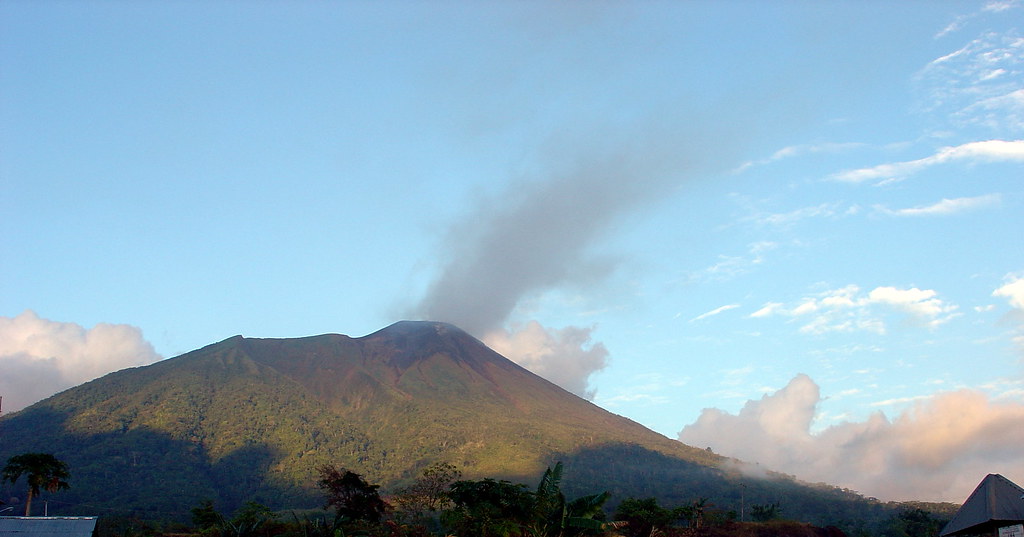
Approaching Mount Gamalama, the imposing conical silhouette of the volcano dominates Ternate Island’s skyline. The trek immerses hikers in a landscape shaped by centuries of volcanic power, where lush tropical plantations give way to barren volcanic ash and rugged lava fields. The air carries the faint scent of sulfur, hinting at the volcano’s restless nature. As you ascend, the contrast between the vibrant island life below and the stark volcanic terrain above deepens, culminating in the emotional moment of standing at the crater rim, gazing into the steaming heart of one of Indonesia’s most active volcanoes.
The Volcano Itself: Geological Background
Mount Gamalama is a near-perfect conical stratovolcano that forms the entirety of Ternate Island in the Maluku Islands of Indonesia. Rising to 1715 meters, it is one of the region’s most active volcanoes, with documented eruptions dating back to the 16th century. The volcano features multiple craters and cones, including Arfat, Madiena, and the summit cones, shaped by frequent eruptions ranging from effusive basaltic lava flows to violent andesitic explosions. The 1775 eruption was particularly devastating, reshaping the landscape and creating the Tolire Lake crater. The volcano’s summit area is marked by fumaroles emitting sulfurous gases, and the volcanic soils support rich tropical plantations on the lower slopes. Gamalama’s activity is closely monitored due to its proximity to populated areas, with eruptions often preceded by short warning periods.
The Volcano Trek: Terrain and Hiking Experience
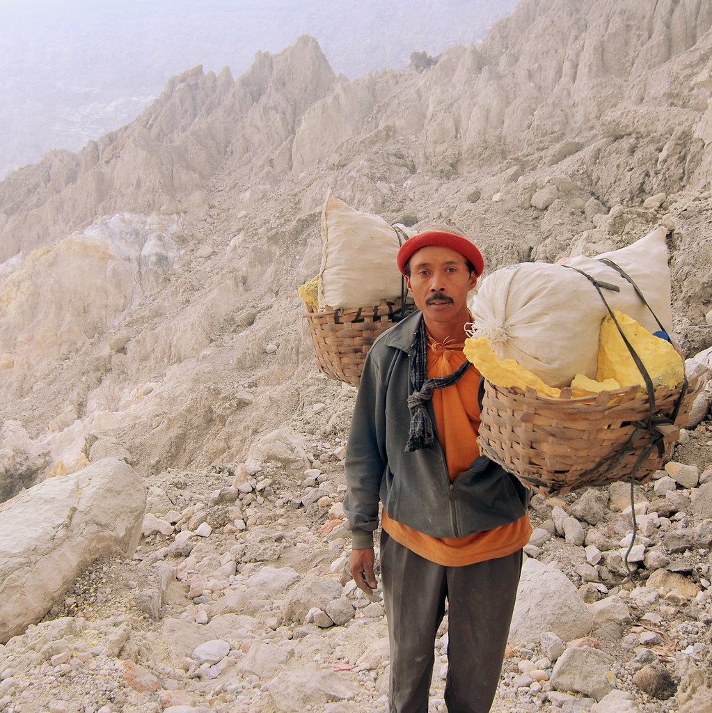
Trekking Mount Gamalama is a demanding yet accessible adventure that takes hikers through diverse volcanic terrain and lush tropical landscapes. The ascent typically begins from either Moya or Marikurubu villages, both situated at elevations around 340-400 meters. The Moya route is longer but favored for its well-defined trail used by local villagers accessing plantations, offering a steadier climb through fragrant clove, nutmeg, cinnamon, and durian groves. The trail gradually transitions from dense tropical forest to open cane grass and volcanic ash slopes.
After approximately three hours, hikers reach the Terminal campground at around 1350 meters, where the two main routes converge. Beyond this point, the terrain becomes more challenging, with steep ravines and loose volcanic scree demanding careful footing. The final ascent to the crater rim involves navigating sharp, loose rocks and potentially hot ground due to sulfur gas emissions. The summit zone is considered sacred by locals, and trekkers are advised to respect cultural practices.
Altitude effects are moderate but noticeable, and weather conditions can shift rapidly, with clouds often rolling in by midday, obscuring views. The trail offers spectacular vistas of surrounding islands and the Maluku Sea on clear days. The entire trek typically requires 7 to 8 hours round trip, demanding reasonable fitness and preparation. Water sources are scarce on the upper trail, so carrying sufficient supplies is essential. Early morning starts with headlamps are recommended to avoid afternoon cloud cover and to enjoy sunrise views.
What Makes This Volcano Trek Unique
Mount Gamalama’s trek is unique for its combination of active volcanic features, rich cultural heritage, and island setting. Unlike many volcanoes, Gamalama forms the entire island of Ternate, offering panoramic views of the surrounding Maluku Sea and neighboring volcanic islands. The volcano’s frequent activity means hikers witness a living geological process, with fumaroles continuously venting sulfur gases near the summit.
Culturally, the mountain holds sacred significance for local communities, with rituals and taboos observed to honor and appease the volcano’s spirit. The trail passes through aromatic spice plantations that historically fueled the global clove trade, linking natural history with human heritage. The presence of colonial forts and the Sultanate’s legacy on the island enriches the trek’s narrative, making it a journey through both earth’s fiery forces and centuries of human history.
The Summit and Crater Experience
Reaching Mount Gamalama’s summit is a profound experience marked by dramatic sensory impressions. At the crater rim, hikers encounter steaming fumaroles emitting sulfurous gases that tint the air with a sharp, acrid scent. The ground beneath may feel warm, a reminder of the volcano’s restless energy. The crater itself is a rugged, raw landscape of volcanic rock and ash, with occasional bursts of steam rising from vents.
The panoramic views from the summit are breathtaking, encompassing the entire island of Ternate, the Maluku Sea, and neighboring islands such as Kiematubu. On clear days, the horizon stretches endlessly, framed by the blue ocean and scattered islets. The silence at the summit is punctuated only by the hiss of escaping gases and the wind sweeping across the barren cone, creating a surreal atmosphere of both power and solitude.
Best Time to Trek Mount Gamalama
The optimal period for trekking Mount Gamalama is during the dry season, from May to October, when weather conditions are most stable and trails are less slippery. During these months, clear skies enhance visibility, allowing spectacular views from the summit. The wet season, from November to April, brings heavy rains that can make the trail hazardous and increase the risk of landslides and slippery volcanic ash.
Volcanic activity can also influence accessibility; the volcano is closely monitored, and climbing is restricted during periods of heightened unrest or eruptions. It is essential to heed local warnings and avoid trekking when the volcano’s alert status is elevated. Early morning climbs are recommended to avoid afternoon cloud cover and sudden weather changes that can obscure views and complicate navigation.
Trekking Routes and Trail Options
Mount Gamalama offers two primary trekking routes starting from villages on the island’s lower slopes: Moya and Marikurubu. The Moya route begins at approximately 341 meters elevation and is preferred by many for its clearer, more gradual trail that passes through spice plantations. It takes about three hours to reach the Terminal campground at 1350 meters, where it joins the Marikurubu route.
The Marikurubu route starts slightly higher at around 400 meters but is steeper and less defined, with a risk of losing the trail on descent. Both routes converge at Terminal, from where the final ascent to the summit involves crossing steep ravines and cane grass fields before reaching the volcanic cone.
The last section to the crater rim is challenging, with loose volcanic rocks and hot sulfur vents. Depending on volcanic activity, access to the crater rim may be restricted for safety. Guided treks are recommended for navigation and safety, with guides available for hire in both Moya and Marikurubu villages or through local hotels in Ternate City. The entire trek typically requires 7 to 8 hours round trip.
Difficulty Assessment
Mount Gamalama is classified as a moderate volcano trek. The trail involves steady elevation gain of approximately 1300 meters over rough volcanic terrain. Hikers face steep sections, loose volcanic ash and rocks, and occasional hot ground near fumaroles. While technical climbing skills are not required, good physical fitness and sure-footedness are essential.
Altitude effects are mild but can affect those unaccustomed to elevation. The trail’s condition varies with weather and volcanic activity, sometimes increasing difficulty. Early starts and proper pacing help manage the challenge. Overall, the trek suits hikers with moderate experience and a readiness for volcanic terrain.
Essential Volcano Trekking Gear
Key gear for trekking Mount Gamalama includes sturdy hiking boots with good grip to handle loose volcanic ash and rocks, trekking poles for stability on steep and uneven terrain, and a windproof jacket to protect against sudden weather changes. A headlamp or flashlight is essential for early morning starts before dawn.
Given the presence of sulfur gases near the summit, a lightweight gas mask or respirator can be helpful for sensitive individuals. Carry sufficient water and high-energy snacks, as water sources are limited on the upper trail. Sun protection such as a wide-brimmed hat, sunglasses, and sunscreen is important due to limited shade. A first aid kit and layered clothing for temperature shifts complete the essential gear list.
Safety and Volcanic Hazards
Mount Gamalama’s active status requires trekkers to exercise caution and respect local safety guidelines. Volcanic hazards include sudden eruptions, emission of toxic sulfur gases, unstable crater edges, and loose volcanic scree that can cause falls. The summit area is particularly hazardous due to fumaroles emitting hot gases and unstable ground.
The volcano is closely monitored by Indonesian volcanology authorities, and access may be restricted during periods of increased activity. Trekkers should always check current volcanic alert levels and heed local warnings. It is recommended to hire local guides familiar with the terrain and volcanic behavior. Emergency evacuation plans are in place, but communication and rescue can be challenging in remote areas.
Weather can change rapidly, with afternoon clouds and rain increasing risks of slips and poor visibility. Proper preparation, awareness of volcanic hazards, and adherence to safety protocols are essential for a safe trekking experience.
Permits, Guides, and Logistics
No formal permits are required to trek Mount Gamalama; however, climbers are requested to sign in at the village starting points in Moya or Marikurubu for safety tracking. The volcano is actively monitored, and access may be temporarily closed during periods of volcanic unrest.
Hiring a local guide is strongly recommended for navigation, safety, and cultural insight. Guides can be arranged in Moya and Marikurubu villages or through hotels in Ternate City. Notable tour operators offering Mount Gamalama treks include Jotje Lala Tours and Travel, Roam Indonesia, and Explore Desa Volcano Tours. These operators provide guided trekking packages, including transportation, guiding services, and sometimes accommodation arrangements.
Logistically, Ternate City serves as the main gateway, accessible by air via Sultan Babullah Airport with connections from major Indonesian cities. From Ternate, local transport options such as motorbike taxis (ojek) or cars can reach the trailheads within 20 to 30 minutes. Trekkers should prepare adequately with water, food, and gear, as facilities along the trail are minimal. The entire trek typically takes a full day, with 7 to 8 hours required for the round trip. Early starts are advised to maximize daylight and avoid afternoon weather changes.
Where to Stay Near Mount Gamalama
Ternate City offers a range of accommodations suitable for trekkers preparing to climb Mount Gamalama. Options include budget guesthouses, mid-range hotels, and eco-friendly lodges. Notable places to stay include Bela International Hotel, known for its comfort and central location, Bajawa Hotel offering budget-friendly rooms with ocean views, and Villa Ma’rasai, an eco-friendly guesthouse providing an authentic local experience.
Most accommodations are located within a short 10 to 20-minute drive from the trailheads at Moya and Marikurubu villages. This proximity allows for convenient early morning departures. Facilities in Ternate City include restaurants, gear shops, and tour operator offices where guides can be arranged.
For those seeking a more immersive experience, homestays in Moya village provide cultural interaction and easy access to the trail. However, amenities are basic, so travelers should plan accordingly. It is advisable to book accommodations in advance during peak trekking season (May to October) to ensure availability. Ternate’s compact size and reliable local transport make it easy to combine volcano trekking with exploring the island’s historical sites and coastal attractions.