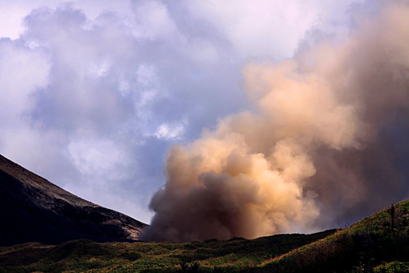

Mount Gamkonora Volcano Trekking Guide: Conquer Halmahera’s Highest Active Stratovolcano
Mount Gamkonora, the highest peak on Halmahera Island, Indonesia, offers a demanding yet rewarding volcano trek through diverse terrain, culminating in spectacular views of active fumaroles and a unique volcanic crater. This guide covers geological insights, trekking routes, safety, permits, and accommodation to prepare adventurers for an unforgettable ascent.
Quick Volcano Snapshot
| Attribute | Value |
|---|---|
| Volcano type | Stratovolcano |
| Elevation | 1,560 meters (5,118 feet) |
| Location | Halmahera Island, North Maluku, Indonesia |
| Activity status | Active |
| Trekking difficulty | Demanding |
| Typical trek duration | 6-8 hours ascent, 3-5 hours descent |
| Altitude gain | Approximately 1,560 meters |
| Terrain type | Coconut, nutmeg, clove plantations; tropical forest; pandanus palms; rocky and sandy volcanic slopes; grasslands |
| Best season | Dry season (May to September) |
| Temperature range | 15°C to 28°C (59°F to 82°F) |
| Permit requirement | Required (local hiking permit and park fees) |
Introduction: The Experience of Hiking Mount Gamkonora
Approaching Mount Gamkonora, hikers are greeted by a towering stratovolcano rising dramatically above the lush tropical landscape of Halmahera Island. The trek begins amidst fragrant coconut and clove plantations, gradually ascending into dense forests where pandanus palms sway in the mountain breeze. The terrain shifts as you climb higher, revealing open ridges and volcanic scree that challenge your footing. The air carries the faint scent of sulfur, hinting at the volcano’s restless nature. Reaching the summit, the panorama unfolds in all directions: distant islands dot the ocean, neighboring volcanoes punctuate the horizon, and the active fumaroles at the crater emit plumes of steam and gas. This journey is a powerful encounter with the raw forces shaping the Earth, blending natural beauty with geological drama.
Geological Background of Mount Gamkonora
Mount Gamkonora is a classic stratovolcano located on Halmahera Island in Indonesia’s North Maluku province. Rising to 1,560 meters, it is the highest peak on the island and part of the Halmahera volcanic arc. The volcano features an elongated series of craters aligned along a north-south rift, a result of tectonic forces shaping the region. Since the 16th century, Gamkonora has produced at least 13 eruptions, ranging from minor explosive events to a major VEI-5 eruption in 1673 that triggered tsunamis devastating nearby villages. The volcano’s summit crater lies within a U-shaped valley flanked by towering walls, with active fumaroles releasing volcanic gases. The volcanic rocks include layers of lava flows, ash deposits, and pyroclastic materials, creating a complex and dynamic landscape. The presence of sulfur deposits and steaming vents adds to the geological interest, making Gamkonora a fascinating subject for both scientists and trekkers.

The Volcano Trek: Terrain and Hiking Experience
The trek up Mount Gamkonora offers a rich and varied hiking experience that challenges and rewards adventurers. Starting just above sea level, the trail initially winds through fragrant coconut, nutmeg, and clove plantations, where the terrain is relatively gentle but requires careful navigation through cultivated land. As you ascend, the path enters dense tropical forest dominated by pandanus palms, providing shade and a lush environment filled with the sounds of native birds and insects. The forested section can be humid and occasionally slippery, especially after rain, demanding sturdy footwear and trekking poles for stability.
Beyond the forest, the trail emerges into a protected forest zone with thicker vegetation and occasional root and rock obstacles. This section is the most physically demanding, particularly between the fourth and fifth posts, where large tree roots and uneven ground require careful footing and moderate scrambling skills. The ascent here is steady but can be tiring, testing endurance and balance.
Above the tree line, the landscape opens to a volcanic grassland dominated by low bracken and cane grass. The trail becomes rockier and sandier, composed of small volcanic stones set in hard-packed sand. This terrain allows for easier climbing but exposes hikers to wind and sun, making sun protection and windproof clothing essential. The volcanic scree can be loose in places, requiring attention to footing to avoid slips.
The final approach to the summit involves a short climb up the eastern flank, passing by vulcanology sensors and fumaroles emitting steam and sulfurous gases. The air here is noticeably warmer and carries the distinct smell of sulfur, a reminder of the volcano’s active status. The summit itself sits on a ridge with panoramic views and a dramatic crater surrounded by towering walls. The crater area features a small seasonal lake with sulfur-rich waters, creating vivid color contrasts against the volcanic rock.
Overall, the trek covers approximately 8 to 12 kilometers round-trip, with an altitude gain of about 1,560 meters. The ascent typically takes 6 to 8 hours depending on pace and weather, while the descent is faster, around 3 to 5 hours. The trail is well-marked but requires a guide for safe navigation through plantations and forested areas. Weather conditions can change rapidly, with cooler temperatures and strong winds near the summit, so layered clothing is recommended. The diverse terrain—from plantations to forest, volcanic scree, and open ridges—makes the hike both physically engaging and visually captivating.
What Makes the Mount Gamkonora Trek Unique
Mount Gamkonora stands out among Indonesia’s volcano treks due to its combination of geological activity, diverse ecosystems, and cultural significance. As the highest volcano in North Maluku, it offers unparalleled views of the surrounding islands and neighboring volcanoes such as Dukono and Gamalama. The summit crater’s U-shaped valley, flanked by towering walls, creates a dramatic natural amphitheater rarely seen on other volcanoes.
The presence of active fumaroles and sulfur deposits at the summit adds a dynamic element, with periodic plumes of steam and gas reminding trekkers of the volcano’s restless nature. The seasonal sulfur-rich lake within the crater provides a striking visual contrast, especially during the rainy season when small waterfalls feed into it.
Culturally, the trek is enriched by local traditions and spiritual sites. The mountain is considered sacred, with a miqat—a sacred boundary marked by ancestral graves—located partway up the trail. This blend of natural beauty, volcanic power, and cultural reverence creates a trekking experience that is both adventurous and meaningful.
The Summit and Crater Experience
Reaching the summit of Mount Gamkonora is a moment of awe and exhilaration. The crater lies in a vast U-shaped valley, surrounded by towering walls that rise steeply on the eastern and western sides. From the northern viewpoint, hikers can gaze over a small, sulfur-stained lake nestled within the crater, its waters shifting in color with the light and volcanic minerals.
The air at the summit is tinged with the sharp scent of sulfur, and steam vents intermittently release plumes of gas that swirl in the cool mountain breeze. The ground beneath your feet is warm in places, a tactile reminder of the volcanic forces below. The soundscape includes the occasional hiss of escaping gases and the distant calls of birds.
Panoramic views stretch in all directions: to the north, the west coast of Halmahera with its scattered offshore islands; northeast towards the active Dukono volcano; east and southeast to the rugged, non-volcanic mountains of southern Halmahera; and south to other volcanic peaks like Gamalama and Makian. The broad ridge descending north from the summit is carpeted with low bracken and frequented by local deer, adding a touch of wildlife to the stark volcanic environment.
This summit experience is a profound encounter with nature’s power and beauty, combining geological spectacle with serene vistas that reward the effort of the climb.
Best Time to Trek Mount Gamkonora
The optimal time to trek Mount Gamkonora is during the dry season, from May to September, when trails are less slippery and weather conditions are more stable. Morning starts are recommended to avoid the afternoon heat and to allow ample time for ascent and descent before dusk. Temperatures range from 15°C in the early morning to around 28°C during the day, but can drop near the summit, so layered clothing is essential.
Avoid the rainy season (October to April), as heavy rains can make trails muddy and hazardous, increasing the risk of slips and complicating navigation through dense forest. Additionally, volcanic activity can fluctuate, so it is important to check current conditions and any alerts from local volcanology authorities before planning your trek.
Volcanic gas emissions and fumarole activity may vary seasonally, and guides will advise on safe access times. Early morning climbs also offer clearer views and calmer winds, enhancing the overall trekking experience.
Trekking Routes and Trail Options on Mount Gamkonora
The primary trekking route to Mount Gamkonora’s summit begins near the Volcanology Post, located just above sea level close to Gamkonora Village. This trail covers approximately 8 to 12 kilometers round-trip, with an elevation gain of about 1,560 meters. The ascent typically takes between 6 to 8 hours, while the descent requires 3 to 5 hours.
The trail passes through several distinct zones: starting with agricultural plantations of coconut, nutmeg, and clove, then entering dense tropical forest dominated by pandanus palms. Higher up, the path traverses protected forest areas with challenging root and rock obstacles, before emerging into open volcanic grasslands and rocky scree slopes near the summit.
There are several rest points and posts along the way, including a notable viewpoint at approximately 1,330 meters elevation overlooking the crater lake and surrounding walls. The final climb involves a short but steep ascent up the eastern flank to reach the summit ridge and crater rim.
While the main route is well-established, alternative paths are limited due to the rugged terrain and volcanic activity. Hiring a local guide is strongly recommended to navigate the plantations and forest trails safely, as well as to provide insights into the natural and cultural features along the route.
Some tour operators, such as Climb Indonesia, offer bespoke private adventures combining Mount Gamkonora with nearby volcanoes like Dukono, providing multi-day trekking options with logistical support. These guided tours include transportation, permits, and accommodation arrangements, enhancing the overall experience.
Difficulty Assessment of the Mount Gamkonora Trek
Mount Gamkonora is classified as a demanding volcano trek, suitable for hikers with good physical fitness and some prior trekking experience. The trail’s length, elevation gain, and varied terrain require endurance, balance, and careful footwork.
The ascent involves steady climbing through plantations and forest, with sections of uneven ground, exposed roots, and rocky paths. The most challenging segment lies between the fourth and fifth posts, where large tree roots and steep slopes test agility and strength. Above the tree line, the volcanic scree and open ridges expose hikers to wind and sun, necessitating proper gear and hydration.
Altitude is moderate at 1,560 meters, so altitude sickness is uncommon but possible for sensitive individuals. Weather conditions can change rapidly, with cooler temperatures and strong winds near the summit adding to the challenge.
Technical climbing skills are not required, but trekking poles, sturdy boots, and experience with uneven terrain are essential. The use of a local guide is highly recommended for safety and navigation. Overall, the trek is demanding but accessible to well-prepared adventurers.
Essential Volcano Trekking Gear for Mount Gamkonora
Preparing for the Mount Gamkonora trek requires gear suited to tropical volcanic terrain and variable weather. Essential items include sturdy hiking boots with good grip for rocky and slippery surfaces, and trekking poles to aid balance on uneven ground and steep sections.
Layered clothing is important: moisture-wicking base layers, insulating mid-layers, and a windproof, waterproof outer shell to protect against sudden rain and wind near the summit. A wide-brimmed hat and UV-protective sunglasses shield from intense sun exposure on open ridges.
Given the presence of volcanic gases and sulfur fumes near fumaroles, carrying a lightweight gas mask or respirator can enhance comfort and safety, especially for sensitive individuals.
Additional essentials include a headlamp for early starts or late finishes, sufficient water and hydration systems, high-energy snacks, and a first aid kit. Sunblock and insect repellent are also recommended due to tropical conditions.
A backpack with rain cover, map or GPS device, and communication tools complete the gear list. Hiring a local guide often includes some equipment support and valuable advice on gear.
Safety and Volcanic Hazards on Mount Gamkonora
Mount Gamkonora is an active volcano with a history of explosive eruptions and ongoing fumarolic activity, necessitating careful attention to safety. Volcanic gases such as sulfur dioxide can be harmful; hikers should avoid prolonged exposure near fumaroles and consider carrying gas masks if sensitive.
The trail includes unstable crater edges and loose volcanic scree, increasing the risk of slips and falls. Strong winds near the summit can exacerbate these hazards. Falling rocks and sudden weather changes, including heavy rain and fog, can reduce visibility and trail safety.
Eruptive activity, while currently moderate, can escalate with little warning. It is essential to monitor updates from the Center of Volcanology and Geological Hazard Mitigation (CVGHM) and heed local advisories. Hiring experienced local guides enhances safety by providing real-time knowledge of volcanic conditions and trail status.
Emergency plans should be in place, including communication devices and knowledge of evacuation routes. Respect for sacred zones and cultural restrictions also contributes to a safe and respectful trekking experience.
Permits, Guides, and Logistics for Mount Gamkonora Trekking
Trekking Mount Gamkonora requires obtaining a local hiking permit, typically issued by authorities at the trailhead or nearby villages. The entrance fee ranges from approximately Rp10,000 to Rp20,000 per person, which supports conservation and local management. Permits are mandatory to ensure safety and regulate visitor impact.
Hiring a local guide is strongly recommended and often essential. Guides assist with navigation through plantations and forest trails, provide safety oversight, and enrich the experience with cultural and geological knowledge. Guide fees generally range from Rp200,000 to Rp300,000 per day, negotiable based on trek duration and group size.
Several reputable tour operators offer organized trips to Mount Gamkonora, including Climb Indonesia and Indonesia Tourism Adventure. These operators provide comprehensive packages covering permits, guides, transportation, accommodation, and equipment rental if needed. Their expertise ensures a smooth and safe trekking experience.
Logistically, the journey begins from Ternate City, the capital of North Maluku Province. From Ternate, travelers take a ferry or speedboat to Sofifi on Halmahera Island, followed by a 4 to 5-hour drive to Gamkonora Village, the trailhead. Local transport options include rented cars or motorbike taxis (ojek).
Accommodation near the trailhead is limited but can be arranged in local guesthouses or campsites. Trekkers should prepare for basic facilities and bring necessary supplies. The best time to start the trek is early morning to maximize daylight and favorable weather.
Overall, careful planning and use of local services enhance safety, cultural respect, and enjoyment of this active volcano adventure.
Where to Stay Near Mount Gamkonora and Nearby Bases
Accommodation options near Mount Gamkonora are modest but sufficient for trekkers seeking proximity to the trailhead. The primary base is Gamkonora Village, located near the Volcanology Post where the trek begins. Here, visitors can find simple guesthouses and homestays offering basic amenities such as beds, meals, and local hospitality.
For those preferring more comfort, nearby towns such as Sofifi, the capital of North Maluku Province, provide hotels and bungalows with better facilities. Sofifi is approximately a 2 to 3-hour drive from Gamkonora Village and serves as a logistical hub for transportation and supplies.
Ternate City, accessible by air via Sultan Babullah Airport, is the main gateway to the region. It offers a range of accommodations from budget hostels to mid-range hotels. Travelers typically stay in Ternate before transferring to Halmahera Island by ferry or speedboat.
Camping is also an option near the base camp or along the trail for experienced trekkers seeking immersion in nature. However, facilities are minimal, so campers must be self-sufficient with gear and provisions.
Local guides and tour operators often assist with accommodation arrangements, ensuring access to reliable lodging and transport. Given the limited infrastructure, early booking and clear communication with hosts are advisable.
Overall, while accommodations near Mount Gamkonora are basic, they provide authentic local experiences and convenient access to the volcano’s trailhead.