
Hiking Lava Butte: Your Expert Guide to Oregon’s Iconic Cinder Cone Volcano Trek
Explore Lava Butte, a dormant cinder cone volcano in Oregon’s Newberry National Volcanic Monument. This guide covers geology, hiking terrain, routes, permits, gear, safety, and nearby accommodations for an unforgettable volcano trekking experience.
Quick Volcano Snapshot
| Attribute | Value |
|---|---|
| Volcano type | Cinder cone |
| Elevation | 5,020 ft (1,530 m) |
| Location | Deschutes County, Oregon, United States |
| Activity status | Dormant |
| Trekking difficulty | Easy |
| Typical trek duration | 1.5 to 2 hours |
| Altitude gain | 500 ft (152 m) |
| Terrain type | Cinder slopes, lava fields, paved and dirt trails |
| Best season | Late spring to early fall (May to October) |
| Temperature range | 40°F to 80°F (4°C to 27°C) depending on season |
| Permit requirement | Day use fee required; shuttle fee applies |
The Experience of Hiking Lava Butte
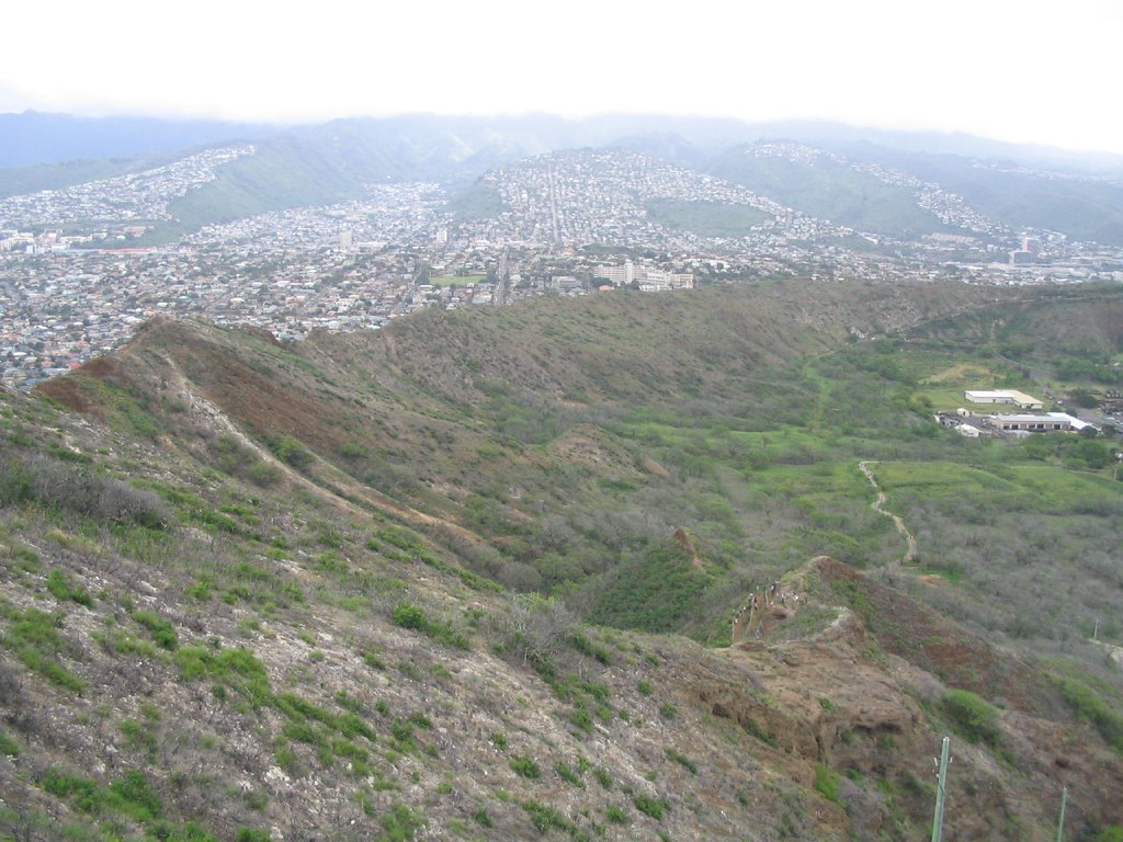
Approaching Lava Butte, the stark contrast between the deep red cinder cone and the surrounding high desert landscape immediately captures your attention. The volcanic terrain tells a story of fiery eruptions and molten lava flows that shaped this region 7,000 years ago. Hiking up the gently spiraling trail, you feel the crunch of volcanic cinders beneath your boots, the air crisp and dry. As you ascend, panoramic views unfold — vast lava fields stretch out like a dark sea, punctuated by smaller cones and the distant Cascade Mountains. Reaching the summit, the sense of standing atop a geological monument is profound. The fire lookout tower offers a 360-degree vantage point to absorb the raw power of the Earth’s volcanic forces and the serene beauty of Oregon’s wilderness.
Geological Background of Lava Butte
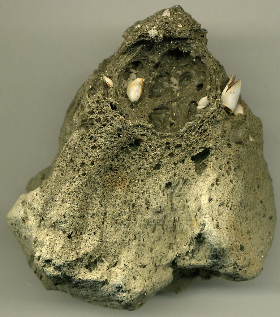
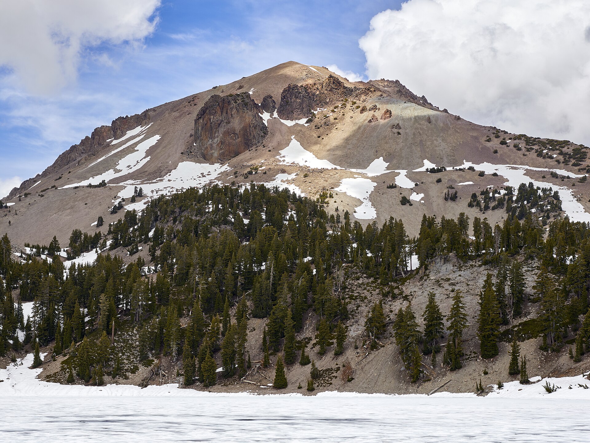
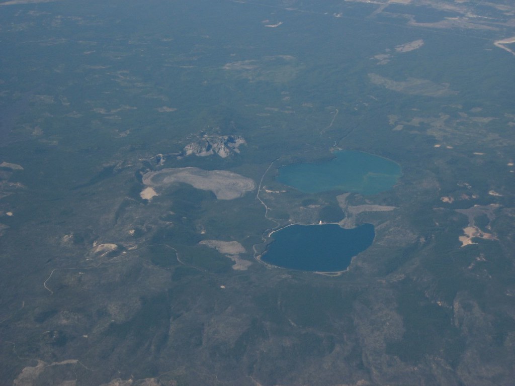
Lava Butte is a classic cinder cone volcano formed approximately 7,000 years ago during a single Strombolian eruption. This type of eruption is characterized by moderate explosive bursts that eject lava fragments into the air, which then cool and accumulate around the vent to form the cone. The cone rises about 500 feet above the surrounding terrain and is composed primarily of basaltic scoria — porous volcanic rock formed from rapidly cooled lava. The eruption also produced extensive lava flows that spread westward, covering several square miles and altering the course of the nearby Deschutes River. These flows created a rugged lava field that remains largely barren, offering a vivid glimpse into the region’s volcanic past. The cinder cone is capped by a crater approximately 60 feet deep on its south rim and 160 feet deep on the north side, providing a natural amphitheater that reveals layers of volcanic deposits. Lava Butte is part of the Newberry National Volcanic Monument, itself a segment of the larger Newberry Volcano, a massive shield volcano that dominates the landscape. The geological features here include lava tubes, caves, and other cinder cones, making it a rich area for volcanic study and exploration.
Terrain and Hiking Experience on Lava Butte
Hiking Lava Butte offers an accessible yet richly rewarding volcanic trekking experience. The primary trail begins at the Lava Lands Visitor Center and ascends via Red Cinder Road, a gently spiraling path composed of loose volcanic cinders and compacted dirt. The trail is approximately 3.5 to 3.9 miles round trip, with an elevation gain of about 500 feet, making it suitable for hikers of most fitness levels. The initial ascent is the most physically demanding section, as the trail climbs steadily with a moderate grade. The volcanic cinders underfoot provide a soft but sometimes slippery surface, requiring sturdy hiking boots with good traction. As you climb, the landscape transitions from ponderosa pine forests at the base to open volcanic terrain near the summit. The air becomes drier and windier, and temperatures can fluctuate significantly, especially on exposed ridges. The trail culminates in a paved loop around the rim of the cinder cone, offering spectacular 360-degree views of the surrounding lava fields, the Cascade Mountains, and the Newberry Caldera. The rim trail is short but can be windy and exposed, so windproof clothing is advisable. The terrain around Lava Butte is marked by jagged lava flows and sharp basalt formations, particularly visible on the Trail of the Molten Land nearby, which hikers can explore for a closer look at volcanic rock textures. The volcanic soil is loose and porous, and the trail is well-maintained but natural, with interpretive signs providing geological context. The hike is often combined with visits to the Lava Lands Visitor Center and the Lava River Cave, enhancing the overall volcanic experience. The trail is open year-round, but winter conditions can bring snow and ice, making the hike more challenging. During the summer months, the trail can be busy, especially on weekends, but the wide path and open space help maintain a comfortable hiking environment. Overall, Lava Butte’s terrain offers a unique blend of volcanic geology and accessible hiking, making it an ideal introduction to volcano trekking in the Pacific Northwest.

What Makes the Lava Butte Trek Unique
Lava Butte stands out as a volcanic trek for its classic cinder cone shape and the panoramic views it offers over an expansive lava field. Unlike many volcanoes that require strenuous climbs or technical skills, Lava Butte’s accessible trails allow hikers to experience volcanic landscapes up close without extreme effort. The surrounding Newberry National Volcanic Monument features a diverse volcanic terrain, including lava tubes and other cinder cones, enriching the trek with geological variety. The presence of a historic fire lookout tower at the summit adds a cultural and historical dimension to the hike. The volcanic landscape here is remarkably well-preserved, with the lava flows still largely barren and the cinder cone retaining its original form. This trek provides a rare opportunity to walk on fresh volcanic deposits and witness the geological processes that shaped the Pacific Northwest. The contrast between the dark lava fields and the green forests, combined with views of the distant Cascade peaks, creates a striking visual spectacle. Additionally, the availability of shuttle services and a visitor center with educational exhibits enhances the experience, making it both adventurous and informative.
Summit and Crater Experience at Lava Butte
Reaching the summit of Lava Butte is a moment of awe and reflection. The fire lookout tower crowns the cinder cone, providing a sheltered observation point with interpretive panels that identify surrounding landmarks. From this vantage, hikers can gaze across the nine-square-mile lava flow that extends westward, a dark and rugged sea of basaltic rock. The crater rim trail encircles the summit, offering unobstructed 360-degree views that include the towering Cascade Mountains, the rim of Newberry Caldera, and the dense ponderosa pine forests below. The air at the summit is often crisp and carries a faint scent of volcanic minerals. The crater itself is a natural amphitheater, revealing layers of volcanic ash, scoria, and basalt that tell the story of the cone’s explosive formation. The summit experience is both serene and powerful, connecting visitors to the dynamic forces that shaped this landscape. The lookout tower’s balcony, open to the public, allows for photography and quiet contemplation, making it a perfect spot to absorb the volcanic grandeur.
Best Time to Trek Lava Butte
The ideal time to hike Lava Butte is from late spring through early fall, typically May to October, when weather conditions are most favorable. During these months, temperatures range from mild to warm, and the trails are generally free of snow and ice. Summer offers long daylight hours and clear skies, perfect for panoramic views and photography. However, summer weekends can be busy, so early morning or late afternoon hikes are recommended to avoid crowds and enjoy softer light on the landscape. The shuttle service to the summit operates from May through Columbus Day, providing an easy ascent option during peak season. Winter and early spring hikes are possible but require caution due to snow, ice, and potentially slick volcanic cinders. Weather in the high desert can change rapidly, so hikers should be prepared for wind and temperature fluctuations. Volcanic activity at Lava Butte is dormant, so there are no eruption-related restrictions, but visitors should always check local conditions and visitor center updates before planning their trek.
Trekking Routes and Trail Options at Lava Butte
Lava Butte offers several hiking options catering to different preferences and fitness levels. The most popular route begins at the Lava Lands Visitor Center, where hikers can choose to either hike or take the shuttle to the summit. The shuttle operates from May through early October and charges a small fee, making the summit accessible to all visitors. For those opting to hike, the Red Cinder Road trail ascends approximately 1.5 to 1.75 miles one way, spiraling gently up the cinder cone with an elevation gain of about 500 feet. This trail is well-marked and composed of volcanic cinders and compacted dirt, providing a moderate but manageable climb. At the summit, the paved rim trail loops around the crater for about 0.35 miles, offering spectacular views. Another option is the Trail of the Molten Land, a short, easy loop near the visitor center that traverses the lava flow itself, allowing hikers to experience the volcanic terrain up close. This trail is paved and suitable for families and casual walkers. For more extended exploration, the nearby Newberry National Volcanic Monument features additional trails such as the Lava River Cave and Black Rock Trail, which can be combined with a Lava Butte hike for a full day of volcanic adventure. Parking is available at the visitor center, but it can fill up during peak times, so arriving early is advisable. When the visitor center is closed, alternative parking is available off Crawford Road, with access to connecting trails. Overall, Lava Butte’s trail system offers flexible options for both quick visits and longer hikes.
Difficulty Assessment of the Lava Butte Trek
Lava Butte is classified as an easy volcano trek, suitable for beginners and families. The trail’s moderate elevation gain of 500 feet over approximately 3.5 to 4 miles round trip presents a manageable challenge for most hikers. The terrain consists mainly of loose volcanic cinders, which can be slightly slippery but are generally stable. The paved rim trail at the summit is flat and accessible. There are no technical climbing sections or exposure to dangerous heights, making the hike safe for those with basic fitness and hiking experience. Altitude is not a significant factor, as the summit elevation is just over 5,000 feet. Weather conditions can influence difficulty; wind and temperature fluctuations are common near the summit, so appropriate clothing is recommended. Overall, the trek requires minimal technical skills but benefits from good footwear and hydration. The availability of a shuttle service also allows visitors to bypass the climb if desired.
Essential Gear for Hiking Lava Butte
When hiking Lava Butte, essential gear includes sturdy hiking boots with good traction to handle loose volcanic cinders and uneven terrain. Trekking poles can provide additional stability on the ascent and descent. A windproof jacket is advisable due to exposed conditions near the summit, where winds can be strong and temperatures cooler. Sun protection is critical, including a wide-brimmed hat, sunglasses, and sunscreen, as the trail offers little shade. Carry sufficient water to stay hydrated, especially during warmer months. A headlamp or flashlight is useful if hiking early morning or late afternoon outside shuttle hours. A small daypack to carry snacks, layers, and personal items is recommended. For those sensitive to volcanic dust, a lightweight dust mask or bandana can help filter particles. Finally, a camera or smartphone is essential to capture the stunning panoramic views from the summit.
Safety and Volcanic Hazards at Lava Butte
Lava Butte is a dormant volcano with no current volcanic activity, making it a safe destination for hikers. However, standard hiking safety precautions apply. The loose volcanic cinders can be slippery, especially on steep sections, so proper footwear and careful footing are essential. The summit rim trail is exposed to wind and weather, which can change rapidly; hikers should be prepared for sudden temperature drops and gusts. There are no active fumaroles or hazardous gases at Lava Butte, but visitors should always heed posted warnings and stay on designated trails to avoid unstable ground or sharp volcanic rock. The fire lookout tower is open to the public on the first floor, but visitors should respect the working staff and avoid restricted areas. In case of emergencies, the nearby Lava Lands Visitor Center provides information and assistance during operating hours. The USGS Volcano Hazards Program monitors volcanic activity in the region, but Lava Butte’s dormancy means eruption risk is negligible. Nonetheless, hikers should remain aware of weather conditions and carry a basic first aid kit.
Permits, Guides, and Logistics for Visiting Lava Butte
Access to Lava Butte requires a day use fee of $5 per vehicle, payable at the entrance station or via a recreation pass such as the Northwest Forest Pass, valid in Oregon and Washington. The Lava Lands Visitor Center serves as the primary gateway, offering parking, restrooms, and educational exhibits. From May through Columbus Day, a shuttle service operates between the visitor center and the summit of Lava Butte, charging approximately $3 per person; children under two ride free. This shuttle provides an easy alternative to hiking the 1.5-mile ascent and is popular among families and casual visitors. Several local tour operators offer guided hikes and educational tours of Lava Butte and the surrounding Newberry National Volcanic Monument. Notable companies include Central Oregon Adventures and Bend Outdoor Guides, which provide expert-led excursions focusing on geology, ecology, and volcanic history. These guided tours often include transportation, interpretive commentary, and visits to nearby attractions such as the Lava River Cave. Visitors planning self-guided hikes should check the visitor center for current trail conditions, shuttle schedules, and weather updates. The area is accessible by car via US Route 97, with clear signage directing to the visitor center. Public transportation options are limited, so renting a vehicle or joining a guided tour is recommended. Overnight permits are not required for day hikes, but camping within the monument requires separate arrangements. Commercial tours must obtain permits from the U.S. Forest Service, which manages the area. Overall, logistics are straightforward, with well-maintained facilities and clear regulations ensuring a smooth visit.
Where to Stay Near Lava Butte
Lava Butte is conveniently located between the towns of Bend and Sunriver, Oregon, both offering a range of accommodations suitable for volcano trekkers. Bend, approximately 10 miles north of Lava Butte, is a vibrant city known for its outdoor culture, craft breweries, and dining options. Here, visitors can find hotels such as the Oxford Hotel, McMenamins Old St. Francis School, and the DoubleTree by Hilton Bend, which provide comfortable amenities and easy access to the trailhead via a short drive. Sunriver, located about 8 miles south of Lava Butte, offers a more resort-style experience with lodges and vacation rentals nestled among pine forests. The Mulligan Estate in Sunriver is a luxurious six-bedroom retreat featuring spacious living areas, a hot tub, and proximity to bike paths and golf courses, ideal for groups seeking comfort after a day of hiking. For budget-conscious travelers, several motels and inns in Bend and Sunriver provide affordable lodging with convenient access to the volcano. Additionally, the Lava Lands Visitor Center area has limited parking and no overnight accommodations, so staying in nearby towns is necessary. Many accommodations offer shuttle services or can arrange transportation to the visitor center. For those interested in extended exploration, Bend serves as a hub for multiple volcanic and outdoor attractions, making it an excellent base for multi-day adventures. Visitors are advised to book accommodations in advance during peak seasons, as the area attracts many tourists. Overall, the combination of urban amenities and natural beauty in Bend and Sunriver ensures a comfortable and convenient stay for Lava Butte visitors.