
Chachimbiro Volcano Trekking Guide: Exploring Ecuador’s Dormant Stratovolcano and Its Healing Hot Springs
Chachimbiro is a dormant stratovolcano located in the Northern Andes of Ecuador, offering a moderate trekking experience through volcanic terrain and unique geothermal features. This guide covers the geological background, trekking routes, terrain challenges, safety tips, permit requirements, and accommodation options near the volcano’s famous hot springs.
Quick Volcano Snapshot
| Attribute | Value |
|---|---|
| Volcano type | Stratovolcano |
| Elevation | 4,604 meters |
| Location | Imantag, Cotacachi Canton, Imbabura Province, Northern Andes, Ecuador |
| Activity status | Dormant |
| Trekking difficulty | Moderate |
| Typical trek duration | 4–6 hours round trip |
| Altitude gain | Approximately 600–800 meters |
| Terrain type | Volcanic ash slopes, rocky lava fields, and geothermal areas |
| Best season | Dry season from June to September |
| Temperature range | 5°C to 18°C (41°F to 64°F) |
| Permit requirement | No special permits required; local guides recommended |
Introduction: The Experience of Hiking Chachimbiro Volcano
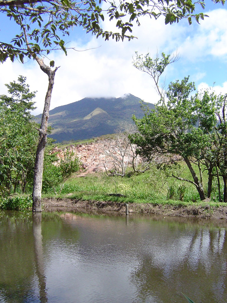
Approaching Chachimbiro volcano, hikers are greeted by a striking landscape where rugged volcanic slopes meet lush Andean greenery. The dormant stratovolcano’s imposing silhouette rises above the surrounding valleys, inviting adventurers to explore its geological secrets. The trek offers a unique contrast between barren lava fields and vibrant natural hot springs at the base, creating a sensory journey of earth’s raw power and soothing warmth. Reaching the crater rim, trekkers experience a profound connection to the planet’s volcanic forces, surrounded by panoramic views of the Northern Andes. The blend of geological drama and natural healing waters makes Chachimbiro a compelling destination for volcano enthusiasts and nature lovers alike.
The Volcano Itself: Geological Background
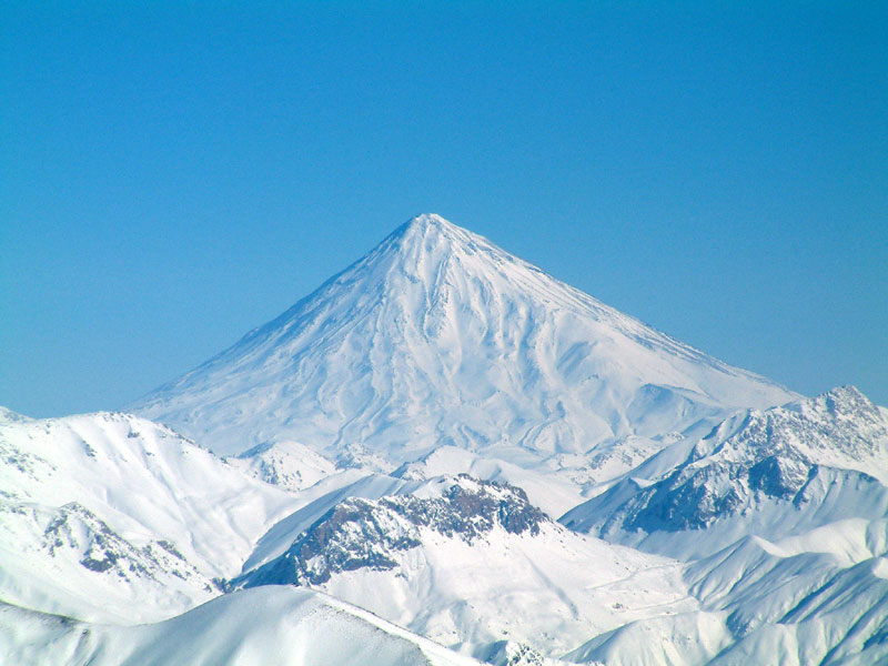
Chachimbiro is a stratovolcano located in Ecuador’s Western Cordillera, part of the Northern Andes volcanic belt. Formed through successive layers of lava flows, ash, and volcanic debris, it stands at 4,604 meters above sea level. Its dormant status means it has not erupted in recent history, but geothermal activity remains evident through hot springs and fumaroles near its base. The volcano’s structure includes a complex crater system and extensive lava fields that reveal its volcanic past. Scientific studies of diffuse CO2 degassing at Chachimbiro indicate ongoing subterranean magmatic processes, highlighting its potential for geothermal energy exploration. The surrounding terrain features volcanic minerals and sulfur deposits, contributing to the unique landscape and ecosystem around the volcano.
The Volcano Trek: Terrain and Hiking Experience
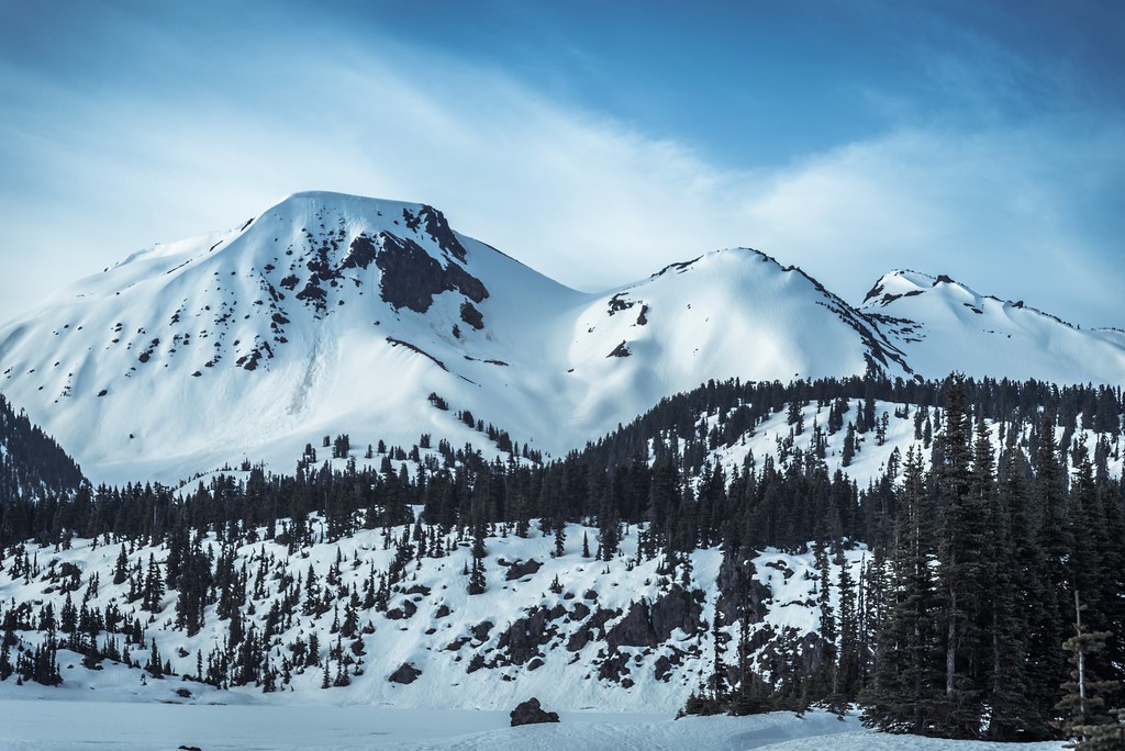
The trek up Chachimbiro volcano offers a moderate challenge suitable for hikers with some experience in high-altitude trekking. The trail begins near the base where the famous hot springs are located, providing a relaxing starting point surrounded by lush vegetation and geothermal steam vents. As hikers ascend, the terrain transitions to volcanic ash slopes and rocky lava fields, requiring careful footing and steady pacing. The volcanic ash can be loose and slippery, especially on steeper sections, demanding good hiking boots with solid grip. The trail includes sections of moderate incline, with occasional rocky outcrops that require light scrambling. Altitude gain is gradual but noticeable, and hikers should be prepared for thinner air and cooler temperatures as they climb above 4,000 meters. Winds can be strong near the summit, adding to the physical challenge and requiring windproof clothing. The volcanic terrain is marked by dark basaltic rocks and scattered pumice, creating a stark contrast with the green valleys below. The crater rim offers exposed ridges with panoramic views, rewarding trekkers with a dramatic perspective of the Northern Andes. Weather conditions can change rapidly, so hikers must be prepared for sudden shifts including fog, rain, or intense sun. Overall, the Chachimbiro trek combines geological intrigue with physical challenge, making it a rewarding experience for those seeking to explore Ecuador’s volcanic landscapes beyond the more frequented peaks.
What Makes This Volcano Trek Unique
Chachimbiro stands out among Ecuadorian volcanoes due to its combination of dormant volcanic terrain and accessible geothermal hot springs. Unlike many active volcano treks that focus solely on summit ascents, Chachimbiro offers the rare opportunity to relax in natural thermal pools enriched by volcanic minerals. This blend of adventure and wellness attracts trekkers interested in both geology and natural healing. The volcano’s moderate difficulty makes it accessible to a wider range of hikers, including those new to high-altitude trekking. Its location in the Northern Andes provides spectacular views of surrounding peaks and valleys, with fewer crowds than more famous volcanoes like Cotopaxi or Chimborazo. The presence of fumaroles and sulfur deposits near the hot springs adds a sensory dimension to the trek, with the smell of sulfur and the sight of steam vents enhancing the volcanic atmosphere. This combination of natural beauty, geological features, and therapeutic waters makes Chachimbiro a distinctive destination for volcano trekking enthusiasts.
The Summit and Crater Experience
Reaching the summit of Chachimbiro volcano, hikers are rewarded with sweeping views of the Northern Andes and the surrounding volcanic landscape. The crater rim is broad and rugged, offering a close-up look at volcanic rock formations and occasional fumarolic activity. The air carries a faint scent of sulfur, and the ground near steam vents feels warm to the touch, a reminder of the volcano’s underlying geothermal energy. From the summit, the panorama includes distant snow-capped peaks and verdant valleys, creating a dramatic contrast with the dark volcanic terrain. The quiet stillness at the top enhances the feeling of standing on a powerful geological monument shaped by millennia of volcanic activity. The experience is both humbling and exhilarating, connecting trekkers with the dynamic forces that have shaped Ecuador’s Andean landscape.
Best Time to Trek This Volcano
The optimal time to hike Chachimbiro is during Ecuador’s dry season, which runs from June through September. During these months, trails are generally clear of mud and the weather is more stable, providing safer and more comfortable trekking conditions. Early mornings are often crisp and clear, ideal for summit attempts and photography. Avoid the wet season from October to May, when heavy rains can make volcanic ash slopes slippery and increase the risk of landslides. Temperature ranges from 5°C to 18°C, with colder conditions near the summit, so layering is essential. Volcanic monitoring indicates Chachimbiro is dormant, so there are no active eruption-related restrictions, but hikers should always check local weather and trail conditions before setting out. Sunrise climbs offer spectacular light on the volcanic landscape, while daytime treks allow for more leisurely exploration of the hot springs and surrounding nature.
Trekking Routes and Trail Options
The primary route to Chachimbiro’s summit starts near the hot springs area accessible from the town of Urcuquí. This trail is approximately 8 to 10 kilometers round trip, with an elevation gain of about 600 to 800 meters. The path initially winds through lush vegetation and geothermal zones, then ascends volcanic ash slopes and rocky terrain toward the crater rim. The trail is well-marked but can be steep in sections, requiring moderate fitness and careful footing. There are no official alternative routes, but local guides may offer variations that include visits to nearby fumaroles or extended hikes around the volcanic complex. Guided tours typically include transportation from nearby towns such as Ibarra or Otavalo, and some itineraries combine the Chachimbiro trek with visits to other Northern Andes attractions. Self-guided hiking is possible but less common due to limited signage and the benefits of local knowledge for safety and interpretation. The trail’s moderate length and difficulty make it suitable for day hikes, with options to relax in the hot springs before or after the ascent.
Difficulty Assessment
Chachimbiro volcano presents a moderate trekking challenge. The terrain includes loose volcanic ash, rocky lava fields, and some steep sections that require surefootedness and a reasonable level of fitness. Altitude is a factor, with the summit at 4,604 meters, so hikers should be acclimatized to avoid altitude sickness. The trek does not require technical climbing skills or specialized equipment, making it accessible to experienced hikers and adventurous beginners with proper preparation. Weather conditions such as wind and temperature fluctuations can add to the difficulty, especially near the summit. Overall, Chachimbiro is classified as a moderate volcano trek, suitable for those comfortable with high-altitude hiking and variable terrain.
Essential Volcano Trekking Gear
For trekking Chachimbiro, essential gear includes sturdy hiking boots with good grip to handle loose volcanic ash and rocky surfaces. Trekking poles are recommended to aid balance and reduce strain on steep sections. Layered clothing is important to adapt to temperature changes, including a moisture-wicking base layer, insulating mid-layer, and a windproof, waterproof outer shell. A hat and sunglasses provide sun protection, as the high altitude increases UV exposure. Carry sufficient water and snacks for energy, and a headlamp if starting early or finishing late. Although volcanic gases are minimal due to dormancy, a lightweight face mask can be useful near fumaroles. A small first aid kit, sunscreen, and a map or GPS device complete the essentials for a safe and comfortable trek.
Safety and Volcanic Hazards
While Chachimbiro is classified as dormant, trekkers should remain aware of potential volcanic hazards such as unstable ground near fumaroles and hot springs, which can cause burns or falls. Loose volcanic ash and rocks increase the risk of slips and falls, especially on steep slopes. Weather can change rapidly, bringing cold temperatures, strong winds, or fog that reduce visibility. It is advisable to hike with a local guide familiar with the terrain and current conditions. Although there is no recent eruptive activity, monitoring by Ecuadorian geological agencies continues, and hikers should heed any official warnings or trail closures. Staying on marked trails and avoiding fumarole areas reduces risk. Emergency services are accessible from nearby towns, but communication can be limited on the volcano itself, so preparation and caution are essential.
Permits, Guides, and Logistics
Chachimbiro volcano does not require special permits for trekking, making it an accessible destination for independent hikers. However, hiring a local guide is highly recommended for safety, navigation, and enriching the experience with geological and cultural insights. Several reputable tour operators offer guided treks to Chachimbiro, including Andean Summit Adventure, Cotopaxi Travel, EcuaTouring, Climbing The Seven Summits (CTSS), and High Summits Climbing Ecuador. These companies provide transportation from nearby cities such as Ibarra or Otavalo, professional guides, and sometimes include visits to the hot springs and other local attractions. Costs for guided day hikes typically range from $50 to $120 USD per person, depending on group size and included services. Logistics are straightforward, with the trailhead accessible by road from Urcuquí, approximately 25 kilometers from Otavalo. Visitors should arrange transportation in advance, especially during peak trekking seasons. Accommodation and meals are not usually included in day tours but can be arranged through operators or local lodges. It is advisable to book tours and accommodations ahead of time to ensure availability and to confirm current trail conditions and weather forecasts. Overall, the combination of easy permit access and professional guiding services makes Chachimbiro a convenient and rewarding volcano trekking destination.
Where to Stay Near the Volcano
The best base for exploring Chachimbiro volcano is the town of Urcuquí, located close to the trailhead and hot springs area. Here, visitors can find modest guesthouses and small hotels offering comfortable accommodations with local charm. For a more immersive experience, Hostería Hacienda Chachimbiro is a standout option, featuring multiple thermal pools, saunas, and spa facilities that capitalize on the volcanic hot springs. This lodge provides rooms with private bathrooms, free WiFi, and on-site dining, making it an ideal place to relax before or after the trek. It is situated within easy reach of the volcano and offers a tranquil natural setting surrounded by Andean landscapes. Nearby towns such as Otavalo and Ibarra, approximately 25 to 40 kilometers away, offer a wider range of lodging options including boutique hotels, hostels, and Airbnb rentals. Otavalo is famous for its indigenous market and cultural attractions, providing additional activities for visitors. Transportation from these towns to Urcuquí and the volcano trailhead is available by taxi or arranged through tour operators. For trekkers seeking convenience and comfort, combining a stay at Hostería Hacienda Chachimbiro with day hikes to the volcano and visits to nearby attractions creates a well-rounded Andean adventure.