
Trekking Apoyeque Volcano: Exploring Nicaragua’s Majestic Dormant Caldera and Crater Lake
Apoyeque Volcano, a large dormant caldera in Nicaragua’s Chiltepe Peninsula, offers a unique trekking experience with its vast crater lake, diverse volcanic terrain, and panoramic views of surrounding volcanoes and Lake Managua. This guide covers geology, hiking terrain, routes, permits, accommodations, and safety for adventurous volcano trekkers.
Quick Volcano Snapshot
| Attribute | Value |
|---|---|
| Volcano type | Caldera |
| Elevation | Approximately 450 meters (caldera rim elevation) |
| Location | Chiltepe Peninsula, Managua Department, Nicaragua |
| Activity status | Dormant |
| Trekking difficulty | Moderate |
| Typical trek duration | 3 to 4 hours |
| Altitude gain | Moderate, approximately 200-300 meters |
| Terrain type | Volcanic caldera rim trails, ash slopes, rocky paths, crater lake surroundings |
| Best season | Dry season (December to April) |
| Temperature range | 20°C to 30°C |
| Permit requirement | Permits recommended; guided tours advised |
Introduction: The Experience of Hiking Apoyeque Volcano
Approaching Apoyeque Volcano, trekkers are greeted by the vast expanse of the Chiltepe Peninsula, where the dormant caldera dominates the landscape. The hike offers a compelling contrast between the serene blue waters of the crater lake and the rugged volcanic terrain surrounding it. As you ascend the rim, the panoramic views unfold, revealing neighboring volcanoes like Momotombo and the shimmering Lake Managua. The sense of geological power is palpable here, with the silence of dormancy underscored by the knowledge of Apoyeque’s explosive past. Reaching the crater rim, hikers experience a profound connection to the Earth’s dynamic forces, standing on the edge of a massive volcanic caldera shaped by millennia of fiery activity.
The Volcano Itself: Geological Background
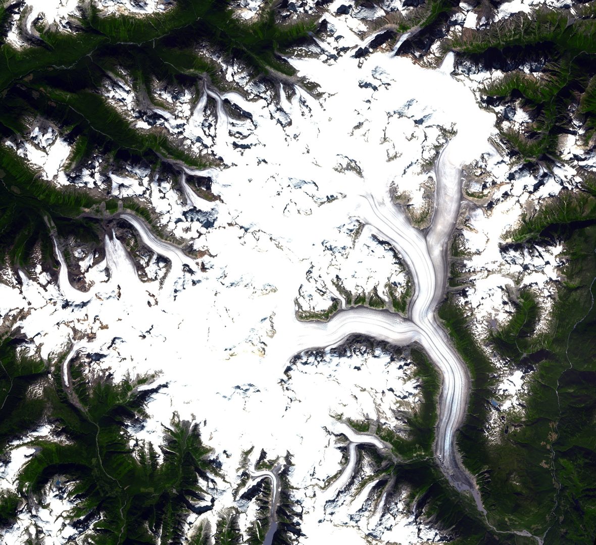
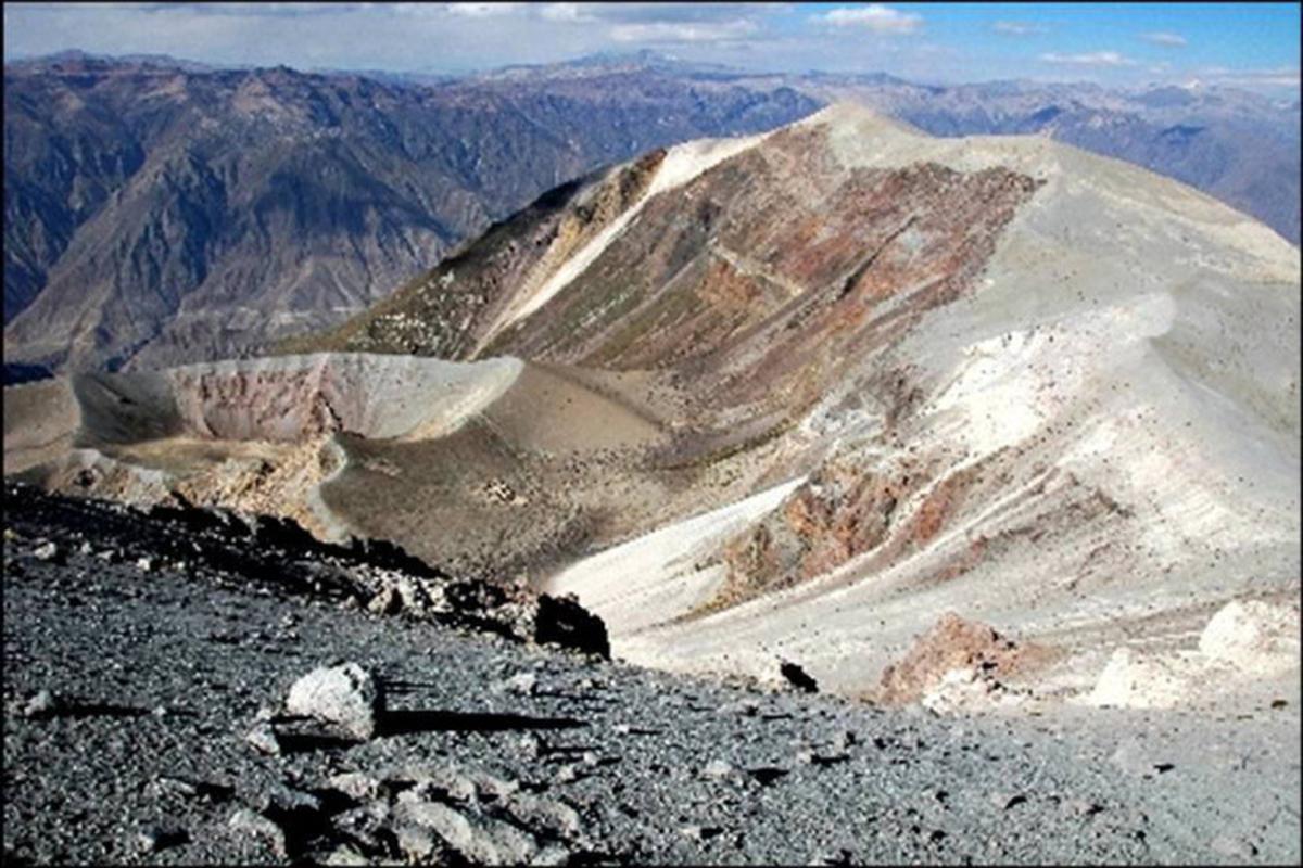
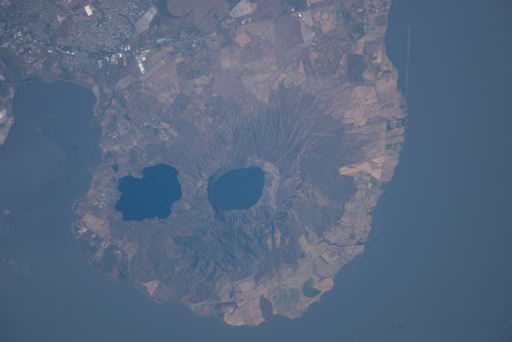
Apoyeque is a large volcanic caldera formed by a massive ignimbrite eruption approximately 2,000 years ago. This eruption created a broad depression now filled by a 2.8-kilometer-wide crater lake about 400 meters deep. The caldera sits on the Chiltepe Peninsula, a geologic structure shaped by successive pyroclastic flows of pumice and ash. These ignimbrite deposits are typical of violent explosive eruptions, where hot mixtures of gas, ash, and rock surge across the landscape. Apoyeque’s last eruption is estimated around 50 BCE, with more recent seismic activity detected in 2012 indicating ongoing subterranean magma movement. The caldera’s rim offers visible fumaroles and sulfur deposits, remnants of its volcanic past. Its proximity to Managua, Nicaragua’s capital, underscores its significance as one of the most potentially dangerous volcanoes globally due to the risk of future eruptions impacting nearby populations.
The Volcano Trek: Terrain and Hiking Experience
Hiking Apoyeque Volcano presents a moderately challenging trek characterized by diverse volcanic terrain. The trail typically begins with a vehicle approach to the base or rim area, followed by footpaths that wind along the caldera’s edge. Trekkers encounter a mixture of firm volcanic ash, loose pumice, and rocky outcrops. The caldera rim trail offers relatively gentle ascents and descents, but some sections feature uneven footing requiring careful navigation. The volcanic soil can be loose and dusty, especially during dry months, making sturdy hiking boots essential for grip and ankle support. Vegetation is sparse near the crater rim, exposing hikers to sun and wind, which can intensify the perceived temperature. The crater lake itself is a striking feature, with trails allowing close views of its tranquil waters. Altitude gain is moderate, generally between 200 to 300 meters, which can cause mild exertion but is manageable for hikers with average fitness. The trail’s exposure to wind and occasional steep sections near fumaroles add to the dynamic hiking experience. Wildlife sightings are occasional, with local bird species and small mammals inhabiting the surrounding natural reserve. Overall, the trek combines geological fascination with physical engagement, rewarding hikers with sweeping vistas of the Chiltepe Peninsula and beyond.
What Makes This Volcano Trek Unique
Apoyeque’s defining feature is its vast caldera filled by a deep crater lake, one of the largest volcanic lakes in Central America. Unlike many volcanoes with steep cones, Apoyeque’s broad, collapsed caldera offers a unique landscape of water and volcanic rock. The panoramic views from the rim encompass multiple neighboring volcanoes, including Momotombo and Momotombito, as well as Lake Managua and the urban sprawl of Nicaragua’s capital city. The volcano’s dormancy allows for safe exploration of fumaroles and sulfur deposits, providing insight into volcanic processes without the immediate threat of eruption. The area’s rich biodiversity and archaeological significance, with indigenous artifacts found nearby, add cultural depth to the natural adventure. This combination of geological grandeur, ecological variety, and historical context makes Apoyeque a distinctive destination for volcano trekkers seeking both adventure and education.
The Summit and Crater Experience
Reaching the rim of Apoyeque’s caldera, hikers are met with a breathtaking 360-degree panorama. The crater lake’s deep blue waters contrast vividly with the surrounding volcanic rock and greenery. The air carries a faint sulfuric scent from fumaroles dotting the rim, and occasional steam vents hiss softly, a reminder of the volcano’s latent power. The crater’s vastness impresses, with the lake’s placid surface reflecting the sky and nearby peaks. From this vantage point, the sprawling city of Managua lies visible in the distance, juxtaposing urban life with raw geological forces. The experience is both humbling and exhilarating, as trekkers stand on the edge of a massive volcanic caldera shaped by ancient cataclysms. The quiet majesty of the summit invites reflection on the Earth’s dynamic nature and the delicate balance between destruction and creation.
Best Time to Trek Apoyeque Volcano
The optimal time to hike Apoyeque is during Nicaragua’s dry season, from December to April, when trails are less slippery and weather conditions are more stable. During this period, temperatures range comfortably between 20°C and 30°C, and rainfall is minimal, reducing the risk of muddy or hazardous paths. The dry season also offers clearer skies, enhancing visibility for panoramic views of the crater lake and surrounding volcanoes. Trekking during the wet season (May to November) is less advisable due to heavy afternoon rains, slippery terrain, and increased risk of sudden weather changes. Additionally, volcanic monitoring is ongoing, and while Apoyeque is dormant, hikers should stay informed about any advisories or restrictions issued by local authorities. Early morning hikes are recommended to avoid midday heat and to experience the calm stillness of the crater at sunrise.
Trekking Routes and Trail Options
The primary trekking route to Apoyeque Volcano typically starts from the nearby town of Bosques de Xiloa or from access points on the Chiltepe Peninsula. Most hikers begin with a short vehicle ride to the base or rim area, followed by a 3-hour hike circling the caldera rim and descending to viewpoints overlooking the crater lake. The trail is well-defined but can be rocky and uneven in places, requiring moderate fitness and good footwear. Guided tours often include interpretive stops highlighting geological features and local flora and fauna. Alternative routes include shorter loops focusing on the crater lake’s edge or extended hikes combining Apoyeque with nearby volcanic sites on the peninsula. Self-guided trekking is possible but not recommended without local knowledge due to limited signage and the risk of disorientation. Tour operators such as Hola Hola Tours and Quetzal Trekkers Nicaragua provide guided hikes with permit arrangements, transportation, and expert commentary. These tours typically last half a day and can be combined with visits to other attractions in the Managua region.
Difficulty Assessment
Apoyeque Volcano offers a moderate trekking challenge suitable for hikers with average fitness levels. The terrain includes volcanic ash slopes, loose pumice, and rocky paths that require sure-footedness but no technical climbing skills. Altitude gain is moderate, approximately 200 to 300 meters, which may cause mild exertion but is generally manageable. The trail’s exposure to sun and wind can increase physical demands, so adequate hydration and sun protection are essential. The hike does not require specialized mountaineering equipment, making it accessible to most adventurous travelers. However, the volcanic terrain’s unevenness and occasional steep sections near fumaroles necessitate caution. Overall, Apoyeque is classified as a moderate volcano trek, offering rewarding views and geological interest without extreme difficulty.
Essential Volcano Trekking Gear
For trekking Apoyeque Volcano, essential gear includes sturdy hiking boots with good grip to navigate loose volcanic ash and rocky terrain safely. Trekking poles are recommended to aid balance on uneven paths and reduce strain on knees during descents. A wide-brimmed hat and high-SPF sunscreen are vital due to limited shade along the caldera rim. Lightweight, breathable clothing suited for warm temperatures and wind protection layers are advisable. Carrying sufficient water is critical, as there are no water sources on the trail. A small first aid kit, sunglasses, and a camera to capture the stunning vistas complete the gear list. While volcanic gases are minimal at Apoyeque, sensitive individuals may consider a lightweight respirator or mask. A headlamp is useful if hiking early morning or late afternoon. Finally, a map or GPS device and a fully charged mobile phone enhance safety.
Safety and Volcanic Hazards
Although Apoyeque is dormant, safety precautions are essential when trekking near volcanic terrain. The caldera rim features fumaroles emitting sulfurous gases that can be irritating; hikers with respiratory sensitivities should take care. The terrain includes loose volcanic ash and pumice, increasing the risk of slips and falls, especially on steep sections. Unstable crater edges require caution to avoid accidents. Sudden weather changes, including strong winds and rain, can affect trail conditions and visibility. While there is no immediate eruption risk, seismic activity has been recorded near Apoyeque, so hikers should heed any warnings from Nicaragua’s volcanic monitoring agencies. It is strongly recommended to hike with a guide familiar with the area and current conditions. Carrying a communication device and informing others of your itinerary enhances safety. Respecting local regulations and staying on marked trails helps preserve the fragile environment and reduces hazards.
Permits, Guides, and Logistics
Access to Apoyeque Volcano generally requires permits issued by local authorities, and it is highly recommended to arrange guided tours for safety and navigation. Tour operators such as Hola Hola Tours, Quetzal Trekkers Nicaragua, and Volcano Day offer organized hikes including transportation from Managua, permit processing, and expert guides knowledgeable in volcanic geology and local ecology. Permit costs are modest but vary depending on the operator and group size. Booking tours at least a few days in advance is advised to secure permits and ensure availability. The volcano is located approximately 16 kilometers from Managua, reachable by car or tour vehicle in about 45 minutes to one hour. Guides provide valuable insights into the volcano’s history, geology, and cultural significance, enhancing the trekking experience. Self-guided hikes are possible but not recommended due to limited signage and the potential for disorientation on volcanic terrain. Logistics for the trek include carrying sufficient water and sun protection, as there are no facilities on the trail. Combining Apoyeque with visits to nearby volcanic sites or natural reserves is common in guided itineraries. Overall, guided tours offer the safest and most informative way to explore Apoyeque Volcano.
Where to Stay Near Apoyeque Volcano
Accommodation options near Apoyeque Volcano primarily center around Managua, the capital city located about 16 kilometers southeast of the volcano. Managua offers a range of hotels, guesthouses, and hostels catering to various budgets. Popular choices include centrally located hotels with easy access to transportation for day trips to Apoyeque. For travelers seeking a more tranquil setting closer to nature, lodges and cabins are available in the surrounding Chiltepe Peninsula and nearby towns such as Bosques de Xiloa. Some private rentals and eco-lodges provide peaceful environments with views of the volcanic landscape, ideal for relaxation after trekking. While there are no accommodations directly on the volcano, the proximity of Managua ensures convenient access to amenities, restaurants, and tour operators. Booking in advance is recommended, especially during the dry season when trekking activity peaks. Many tour companies offer combined packages including hotel pickup and drop-off, simplifying logistics. Staying in Managua also allows exploration of other regional attractions, making it a practical base for volcano adventures.