
Trekking Tungurahua Volcano: An Expert Guide to Ecuador’s Fiery Giant
Tungurahua Volcano, an active stratovolcano in Ecuador’s Avenue of the Volcanoes, offers a demanding yet rewarding trekking experience. This guide covers its geology, terrain, routes, safety, permits, and accommodations for adventurers seeking to conquer its fiery summit.
Quick Volcano Snapshot
| Attribute | Value |
|---|---|
| Volcano type | Stratovolcano |
| Elevation | 5,023 meters (16,480 feet) |
| Location | Cordillera Oriental, Ecuador, Avenue of the Volcanoes |
| Activity status | Active |
| Trekking difficulty | Demanding |
| Typical trek duration | 2 days (including refuge stay and summit ascent) |
| Altitude gain | Approximately 2,200 meters (7,200 feet) from trailhead to summit |
| Terrain type | Steep ash slopes, volcanic scree, rocky steps, cloud forest, Andean páramo |
| Best season | June to September (dry season) |
| Temperature range | Daytime 5°C to 15°C; summit temperatures can drop below freezing |
| Permit requirement | Yes, park entry permit and refuge fees required |
Introduction: The Experience of Hiking Tungurahua Volcano
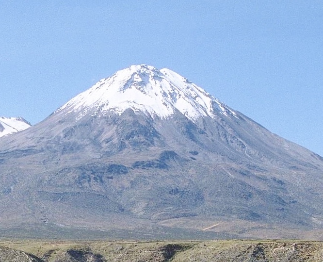
Approaching Tungurahua Volcano, known as the “Throat of Fire,” is an encounter with raw geological power. The towering stratovolcano dominates the landscape with its imposing, often smoke-crowned summit. As you ascend, the barren volcanic slopes contrast starkly with the lush greenery of the surrounding valleys and cloud forests. The air grows thinner and cooler, the terrain more rugged and volcanic ash-laden. Reaching the crater rim, the earth’s fiery heart reveals itself through fumaroles and the occasional glow of molten lava during eruptive phases. The emotional impact of standing on this active giant, feeling the heat beneath your feet and hearing the rumble of the earth, is unforgettable for any volcano trekker.
The Volcano Itself: Geological Background
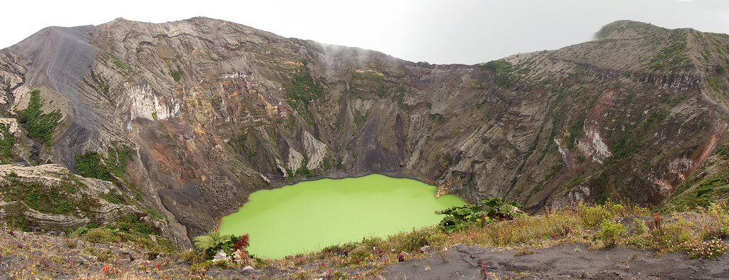
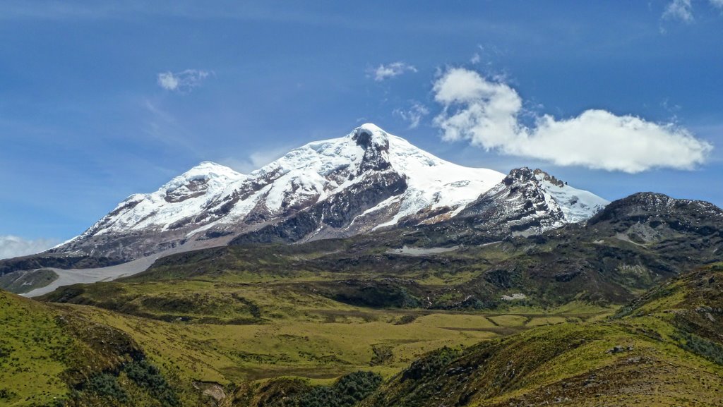
Tungurahua is a classic stratovolcano rising to 5,023 meters in Ecuador’s Cordillera Oriental. Its name derives from the indigenous Quechua language, meaning “Throat of Fire,” reflecting its fiery activity. The current volcanic edifice, Tungurahua III, formed within the caldera of its predecessor after a major collapse about 3,000 years ago. Historically, Tungurahua has exhibited Strombolian eruptions characterized by explosive bursts, pyroclastic flows, and lava emissions. Since its reactivation in 1999, it has remained active with frequent eruptive episodes. The volcano’s summit crater, approximately 183 meters wide, is a dynamic landscape of fumaroles, sulfur deposits, and volcanic ash. The melting of its small summit glacier due to increased activity has altered its snowline, emphasizing the volcano’s ongoing geological transformation.
The Volcano Trek: Terrain and Hiking Experience
Trekking Tungurahua is a physically demanding adventure that challenges hikers with diverse and rugged terrain. The journey typically begins at the Sangay National Park entrance near Pondoa, at around 2,600 meters elevation. From here, the trail ascends through dense Andean cloud forest rich with orchids, mosses, bromeliads, and ferns. This initial section offers a lush, green contrast to the volcanic landscape above. As the trail climbs higher, vegetation thins and transitions into the páramo ecosystem, characterized by tussock grasses and hardy shrubs adapted to cold, windy conditions.
The path becomes steeper and rockier, with loose volcanic ash and pumice underfoot, demanding careful footing and good hiking boots. Hikers encounter sandy slopes and scree fields that require steady balance and endurance. The ascent to the refuge at approximately 3,800 meters is a key acclimatization point, where trekkers can rest and prepare for the summit push.
Above the refuge, the terrain grows more exposed and challenging. The final ascent involves scrambling over volcanic rocks and negotiating steep, unstable scree slopes. Weather conditions can change rapidly, with strong winds and temperature drops common near the summit. Altitude sickness is a risk due to the rapid elevation gain from the trailhead to the 5,023-meter peak.
The volcanic ash and loose rock create a unique hiking surface that can be slippery and unstable, requiring trekking poles for balance. The trail offers spectacular views of the surrounding Andes, including neighboring volcanoes like Chimborazo and Carihuairazo. The soundscape is punctuated by the occasional rumble of volcanic activity, adding to the sense of adventure.
Descending can be equally challenging, as loose scree and ash slopes require controlled sliding or careful stepping. Some tours offer a thrilling mountain bike descent from the refuge back to Baños, combining endurance hiking with adrenaline-pumping biking.
Overall, the trek demands good physical fitness, proper acclimatization, and preparedness for variable weather and volcanic conditions. The terrain’s volcanic nature makes it a distinctive and exhilarating experience for seasoned trekkers and volcano enthusiasts.

What Makes This Volcano Trek Unique
Tungurahua stands out for its persistent volcanic activity, offering trekkers the rare opportunity to witness an active volcano’s power firsthand. Its frequent eruptions produce spectacular night-time lava glows visible from nearby towns, creating a dramatic and unforgettable spectacle. The volcano’s cultural significance as “Mama Tungurahua” to local indigenous communities adds a profound spiritual dimension to the trek.
The combination of diverse ecosystems—from cloud forests to barren volcanic slopes—provides a rich natural tapestry. The proximity to Baños, a town famed for its hot springs and adventure tourism, allows for a unique blend of cultural immersion and outdoor challenge. Additionally, some tours combine trekking with mountain biking descents, adding an exciting multi-activity dimension.
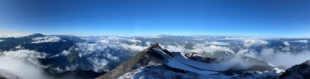
The summit offers panoramic views of Ecuador’s highest peaks and the lush Amazon basin, a rare vantage point that connects volcanic grandeur with tropical biodiversity. The dynamic volcanic landscape, with fumaroles, sulfur deposits, and ash fields, creates a geological playground unlike any other.
The Summit and Crater Experience
Reaching Tungurahua’s summit is a moment of intense reward and awe. At 5,023 meters, the crater rim reveals a vast, steaming caldera approximately 183 meters wide. The air is thin and cold, and the smell of sulfur is unmistakable, mingling with the crisp mountain breeze. Fumaroles emit hissing steam and gases, while the ground beneath radiates residual heat from the volcano’s fiery core.
From the summit, trekkers are treated to sweeping views of the Andes, including iconic peaks such as Chimborazo, Carihuairazo, and Cotopaxi. On clear days, the lush Amazon rainforest stretches eastward, contrasting vividly with the volcanic terrain. The crater’s raw power is palpable, with occasional rumbles and ash plumes reminding visitors of the volcano’s active nature.
The sensory experience is heightened by the stark landscape, the interplay of light and shadow on volcanic ash, and the profound silence punctuated by natural volcanic sounds. Photographers find the summit a prime location for capturing the volcano’s dramatic essence, especially during sunrise or sunset.

Best Time to Trek Tungurahua Volcano
The optimal trekking season for Tungurahua is during Ecuador’s dry months, from June to September. During this period, trails are less muddy, and weather conditions are more stable, reducing the risk of sudden storms and slippery terrain. Early mornings and late afternoons offer the best light for photography and more comfortable temperatures.
Volcanic activity can influence trekking schedules; eruptions or increased seismic activity may lead to temporary trail closures or restrictions. It is essential to monitor updates from the Ecuadorian Geological Institute (IGEPN) and local authorities before planning a climb.
Avoiding the rainy season (October to May) is advisable, as heavy rains increase the risk of landslides and make the volcanic ash slopes treacherous. Night climbs are popular for viewing lava glows but require additional safety precautions and proper lighting equipment.
Acclimatization is crucial; spending a day in Baños or nearby towns before ascending helps reduce altitude sickness risks. Weather near the summit can be unpredictable, with rapid temperature drops and strong winds, so layered clothing and waterproof gear are essential.
Trekking Routes and Trail Options
The primary trekking route to Tungurahua’s summit begins at the Sangay National Park entrance near Pondoa, at approximately 2,600 meters elevation. From here, hikers follow a well-marked trail ascending through cloud forest and páramo ecosystems to the refuge at 3,800 meters. This approach is the most common and recommended for acclimatization and safety.
The trek to the refuge typically takes 3 to 4 hours, with moderate to steep gradients. The refuge serves as an overnight base for summit attempts, providing shelter and basic amenities. From the refuge, the summit ascent starts early (around 1:00 AM) to avoid daytime heat and to maximize summit time during daylight.
The summit climb is steep and challenging, involving sandy slopes, loose scree, and rocky sections. Depending on fitness and weather, the round trip from refuge to summit and back takes approximately 6 to 8 hours.
Alternative routes include shorter day hikes from Baños to the refuge and back, suitable for acclimatization or less experienced hikers. Some tours offer combined trekking and mountain biking, where participants hike up to the refuge and then descend by bike on rugged trails back to Baños, adding an adrenaline element.
Guided tours are strongly recommended due to the volcano’s active status and challenging terrain. Guides provide safety oversight, local knowledge, and logistical support. Self-guided trekking is possible but requires thorough preparation and awareness of current volcanic activity and weather conditions.

Difficulty Assessment
Tungurahua is classified as a demanding volcano trek, suitable for experienced hikers with good physical fitness. The ascent involves significant altitude gain, steep slopes, and unstable volcanic terrain. Hikers must be prepared for rapid weather changes, potential altitude sickness, and the physical strain of climbing above 5,000 meters.
Technical climbing skills are not generally required, but sure-footedness and endurance are essential. The final summit section may require scrambling over loose rocks and negotiating scree fields. Proper acclimatization is critical to avoid altitude-related health issues.
This trek is not recommended for beginners or those with respiratory or cardiovascular conditions due to the altitude and volcanic gases. The presence of active volcanic activity adds an element of risk, making guided tours with experienced leaders the safest option.
Essential Volcano Trekking Gear
Successful trekking on Tungurahua requires specialized gear to handle volcanic terrain and variable weather. Essential items include sturdy hiking boots with excellent grip for loose ash and rocky slopes, trekking poles for balance, and gaiters to protect against volcanic ash.
Layered clothing is vital: moisture-wicking base layers, insulating mid-layers, and waterproof, windproof outer shells. Warm gloves, a wool hat, and a buff or face mask help protect against cold and ash inhalation. A headlamp is necessary for early morning summit climbs.
Hydration systems such as camelbacks or water bottles are critical, as the dry volcanic environment can dehydrate hikers quickly. Sun protection—sunglasses, sunscreen, and a wide-brimmed hat—is essential due to high UV exposure at altitude.
Additional recommended gear includes a helmet (provided by guides), crampons if snow is present, a first aid kit, energy snacks, and a camera to capture the stunning landscapes.
Safety and Volcanic Hazards
Trekking Tungurahua requires vigilance regarding volcanic hazards and mountain safety. The volcano is active, with frequent eruptions producing ash plumes, pyroclastic flows, and lava emissions. Sudden eruptions can occur, so monitoring updates from the Ecuadorian Geological Institute (IGEPN) is essential.
Volcanic gases such as sulfur dioxide can pose respiratory risks, especially near fumaroles and the crater rim. Wearing a face mask or buff can mitigate inhalation of ash and gases. The terrain includes unstable crater edges, loose scree, and falling rocks, demanding careful footing and adherence to guide instructions.
Weather conditions can change rapidly, with strong winds, cold temperatures, and rain increasing risks of hypothermia and slips. Emergency shelters exist at the refuge, and guided tours provide safety equipment and evacuation plans.
Visitors should never hike alone, always stay on marked trails, and respect park regulations. Proper acclimatization reduces altitude sickness risks. In case of increased volcanic activity, authorities may close trails for safety.
Permits, Guides, and Logistics
Visiting Tungurahua Volcano requires obtaining permits and planning logistics carefully due to its active status and protected location within Sangay National Park. Entry to the park mandates a permit, which is typically arranged by tour operators or can be purchased at the park entrance. Fees vary but generally include park access and refuge use.
Professional guides are strongly recommended and often required for summit attempts. They provide essential safety oversight, local knowledge, and equipment such as helmets, harnesses, and ice axes. Several reputable tour operators offer comprehensive packages, including transportation from Baños, guide services, refuge accommodation, meals, and climbing gear. Notable operators include Ivaga Tours, Imagine Ecuador, Geotours Ecuador, Fairtravel4u, and Veronika’s Adventure.
Tours usually span two days: the first day involves hiking from the park entrance to the refuge at 3,800 meters, with an overnight stay. The second day starts early with a summit ascent and return to Baños by afternoon. Some tours combine trekking with mountain biking descents, adding variety and excitement.
Costs for guided tours range from approximately $150 to $300 USD, depending on inclusions and group size. Booking in advance is advised, especially during the dry season. Visitors should prepare for early starts, physical exertion, and variable weather.
Transportation logistics typically involve private vehicles or shuttle services from Baños, located about 8 kilometers north of the park entrance. Baños serves as the main base for accommodations and gear rental. Emergency protocols are in place due to the volcano’s activity, and guides are trained to respond to changing conditions.
Overall, engaging a professional tour operator ensures compliance with regulations, enhances safety, and enriches the trekking experience through expert guidance and logistical support.
Where to Stay Near Tungurahua Volcano
The town of Baños de Agua Santa, situated approximately 8 kilometers north of Tungurahua’s trailhead, is the primary base for volcano trekkers. Baños offers a wide range of accommodations, from budget hostels to luxury resorts, catering to diverse traveler preferences.
For those seeking comfort and upscale amenities, Luna Volcán Hotel stands out as a premier option. Located on the lower slopes of the volcano, this rustic-luxe resort features 28 rooms, multiple pools tiered into the volcanic landscape, a spa offering volcano-inspired treatments, and restaurants with panoramic views of the Andes. Its Swiss-Ecuadorian management ensures high standards of service and organization.
Mid-range travelers may consider Spa Hosteria Miramelindo, nestled in lush greenery near the Pailon del Diablo waterfall. This boutique hotel combines modern comforts with vibrant regional decor, a heated pool, spa facilities, and an acclaimed restaurant serving local cuisine. Its tranquil setting is ideal for relaxation after demanding treks.
Budget options include centrally located guesthouses and hostels in Baños, such as twin rooms with private bathrooms and free Wi-Fi, providing easy access to local markets, eateries, and transport services.
For trekkers preferring proximity to the trailhead, some lodges and refuges near the Sangay National Park entrance offer basic accommodations, though many have been affected by recent volcanic activity. The Tungurahua Refuge at 3,800 meters provides shelter during summit attempts but requires booking through tour operators.
Baños also serves as a hub for gear rental, guided tours, and transportation arrangements. Its vibrant town atmosphere, hot springs, and adventure activities complement the volcano trekking experience, making it an excellent base for multi-day exploration.
Visitors are advised to book accommodations in advance during peak trekking seasons and to choose lodging that aligns with their comfort needs and itinerary.