Mount Iwate Volcano Trekking Guide: Exploring Tohoku’s Majestic Stratovolcano
Mount Iwate, the highest volcano in Iwate Prefecture, offers a challenging yet rewarding trekking experience through volcanic landscapes, alpine flora, and panoramic summit views. This guide covers geology, terrain, routes, safety, permits, and accommodation options for adventurers seeking to explore this iconic Japanese stratovolcano.
Quick Volcano Snapshot
| Attribute | Value |
|---|---|
| Volcano type | Stratovolcano |
| Elevation | 2,038 meters |
| Location | Iwate Prefecture, Tohoku, Japan |
| Activity status | Dormant (with recent increased volcanic activity and temporary closures) |
| Trekking difficulty | Moderate |
| Typical trek duration | 6 to 9 hours (depending on route) |
| Altitude gain | Approximately 1,400 to 1,500 meters |
| Terrain type | Volcanic lava flows, ash slopes, loose scree, forest trails |
| Best season | July to October (summer to early autumn) |
| Temperature range | 10°C to 26°C in summer; colder at summit |
| Permit requirement | Currently restricted due to volcanic activity; permits and access subject to local government regulations |
Introduction: The Experience of Hiking Mount Iwate
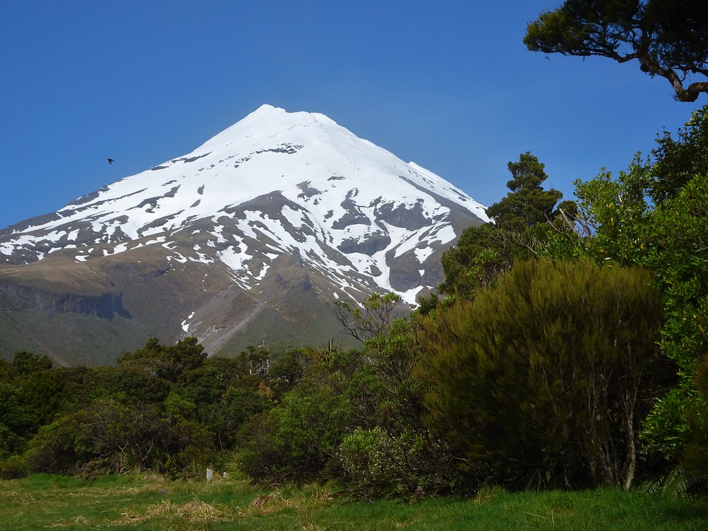
Approaching Mount Iwate, the mountain’s conical silhouette dominates the horizon, evoking a sense of ancient geological power. The trek unfolds through dense forests that gradually give way to barren volcanic terrain, where steaming vents and lime-green mineral deposits hint at the volcano’s restless nature. As you ascend, the landscape shifts dramatically, revealing rugged lava fields and loose scree slopes that challenge your footing. Reaching the summit, the panorama stretches across the Tohoku region, with views of neighboring peaks and the distant Pacific Ocean. The emotional impact of standing atop this iconic stratovolcano is profound, a blend of awe at nature’s forces and accomplishment after a demanding climb.

The Volcano Itself: Geological Background
Mount Iwate is a stratovolcano rising to 2,038 meters, known locally as “Nanbu Fuji” for its resemblance to Mount Fuji’s elegant cone. It formed through successive eruptions that layered lava and ash, creating its classic volcanic profile. The volcano has erupted five times in recorded history, with the most recent activity causing increased fumarolic emissions and steam vents near the summit. Its crater area features volcanic minerals and sulfur deposits, visible as vivid green and yellow hues on the slopes. The mountain’s geology includes lava flows and volcanic scoria, with fumaroles that release gases, reminding hikers of the volcano’s latent power. This complex volcanic structure is part of the northern Ou Mountains and plays a significant role in the region’s natural landscape.
The Volcano Trek: Terrain and Hiking Experience
Hiking Mount Iwate is a demanding but rewarding experience that immerses trekkers in diverse volcanic terrain. The ascent typically begins in lush forests, where the trail winds through beech and fir trees, offering shade and a cool atmosphere. As you climb higher, vegetation thins and the landscape transitions to volcanic rock and ash slopes. The trail surface varies from compact dirt to loose pumice and scree, requiring careful footing especially on the final ascent. The steep ash slopes can be slippery, and hikers often find themselves sliding slightly with each step, demanding steady balance and endurance. Lava rock scrambling is occasional but manageable for those with moderate hiking experience. The ridge sections expose hikers to wind and changing temperatures, which can drop significantly near the summit. Steam vents and fumaroles punctuate the upper slopes, emitting sulfurous gases that add a sensory reminder of the volcano’s activity. The altitude gain of approximately 1,400 meters over a 10 to 20-kilometer round trip means the trek is physically challenging, often taking between 6 and 9 hours depending on pace and route choice. Weather conditions can shift rapidly, with fog and rain common in the mountains, so hikers must be prepared for variable conditions. The trail is well-marked but can be confusing near trailheads, so careful navigation is essential. Overall, the terrain demands good physical fitness, sturdy hiking boots with grip, and trekking poles for stability. The volcanic landscape offers a unique hiking experience, combining natural beauty with geological intrigue and the thrill of ascending an iconic Japanese volcano.

What Makes This Volcano Trek Unique
Mount Iwate stands out for its striking resemblance to Mount Fuji, earning it the nickname “Nanbu Fuji.” Its volcanic terrain is rare in Japan, featuring active fumaroles and sulfur deposits that provide a vivid glimpse into volcanic processes. The mountain’s summit offers panoramic views of the northern Tohoku region, including neighboring peaks like Mt. Himekami and Mt. Hayachine. The diverse ecosystems along the trails—from dense forests to alpine flora near the summit—add botanical interest. The presence of ancient stone Buddhist statues around the summit caldera and the historic Iwatesan-jinja Okunomiya Shrine enrich the cultural experience. Additionally, the proximity to natural hot springs at the mountain’s base allows hikers to relax and rejuvenate after the climb, blending adventure with traditional Japanese wellness.
The Summit and Crater Experience
Reaching the summit of Mount Iwate is a moment of profound reward. The crater rim reveals a rugged volcanic landscape marked by loose scree and steaming fumaroles that emit faint sulfurous scents. The air is crisp and often windy, heightening the sense of isolation and grandeur. From the summit, hikers are treated to sweeping 360-degree views that encompass the Hachimantai area, distant mountain ranges, and on clear days, the Pacific coastline. The sound of escaping volcanic gases adds an eerie soundtrack to the experience, while the sight of ancient stone statues encircling the caldera connects visitors to the mountain’s spiritual heritage. The crater’s rugged beauty and the panoramic vistas combine to create a powerful sensory and emotional experience that lingers long after the descent.
Best Time to Trek Mount Iwate
The ideal trekking season for Mount Iwate is from July through October, when the weather is generally stable and the trails are free of snow. Summer months bring alpine flowers and lush greenery, while autumn offers spectacular foliage colors. Due to the mountain’s volcanic activity, access has been restricted since October 2024, with partial reopening expected in mid-2026 depending on volcanic monitoring. Hikers should always check current volcanic alert levels and local regulations before planning their trip. Weather can change rapidly, with fog, rain, and strong winds common, especially near the summit. Early morning starts are recommended to avoid afternoon storms and to enjoy clearer views. Winter trekking is not advised due to snow and cold temperatures, though the region offers skiing and snowshoeing opportunities nearby.
Trekking Routes and Trail Options
Mount Iwate features seven major hiking trails, each offering distinct landscapes and difficulty levels. The most popular routes include the Umagaeshi (Yanagisawa) Course, Yakehashiri Trail, Nanataki Course, and Matsukawa Trail. The Umagaeshi Trail is suited for beginner to intermediate hikers, with a round-trip duration of about 6 to 7 hours and moderate elevation gain. It begins near Amihari Onsen and passes through forested areas before reaching volcanic terrain. The Yakehashiri Trail is more challenging, featuring rocky terrain and steeper sections, favored by intermediate hikers. The Nanataki Course is a long route (approximately 21 km round trip) that passes the scenic Nanataki Waterfall and volcanic steam vents, requiring an early start and good endurance. Matsukawa Trail offers a route along a beautiful river with thick vegetation, leading to the crater base. Most trails converge near the summit area, where emergency huts and benches provide rest points. Guided hikes are available through local operators such as Go North Japan and the Iwate Mountain Guide Club, who tailor routes based on fitness levels and seasonal conditions. Due to recent volcanic activity, some trails remain closed or partially restricted, so hikers must verify current access status before setting out.
Difficulty Assessment
Mount Iwate is classified as a moderate volcano trek, demanding good physical fitness and hiking experience. The ascent involves approximately 1,400 to 1,500 meters of elevation gain over distances ranging from 10 to 21 kilometers round trip, depending on the chosen route. Terrain challenges include steep ash slopes, loose scree, and occasional lava rock scrambling. The final ascent to the crater rim is particularly strenuous, with loose volcanic gravel causing footing difficulties. Altitude effects are mild but noticeable, as the summit reaches just over 2,000 meters. Weather variability and exposure on ridges add to the challenge. Technical climbing skills are not required, but hikers should be comfortable with sustained uphill hiking and navigating uneven volcanic terrain. The trek is unsuitable for beginners without prior mountain hiking experience.
Essential Volcano Trekking Gear
For a safe and comfortable ascent of Mount Iwate, hikers should equip themselves with sturdy hiking boots featuring good grip for loose volcanic scree and rocky terrain. Trekking poles are highly recommended to aid balance and reduce strain on knees during steep ascents and descents. Layered clothing is essential to adapt to temperature changes and wind exposure near the summit. A windproof and waterproof jacket will protect against sudden weather shifts. Carry sufficient water and high-energy snacks, as there are limited water sources along the trails. A headlamp is useful for early starts or late finishes. Due to fumarolic gases near the crater, sensitive individuals may consider a lightweight gas mask or respirator. Sun protection, including a hat, sunglasses, and sunscreen, is important since volcanic slopes offer little shade. A map, compass, or GPS device is advised for navigation, especially as some trailheads can be confusing. Emergency supplies such as a first aid kit and whistle enhance safety.
Safety and Volcanic Hazards
Mount Iwate’s status as a dormant but active volcano necessitates careful attention to safety. Recent increased volcanic activity has led to trail closures and access restrictions to protect hikers from hazards such as sudden gas emissions, unstable ground near fumaroles, and potential eruptions. Volcanic gases like sulfur dioxide can cause respiratory irritation; hikers should avoid venturing close to steam vents and stay on marked trails. Loose scree and volcanic ash slopes increase the risk of slips and falls, especially on the final ascent and descent. Weather conditions can change rapidly, bringing fog, rain, and strong winds that reduce visibility and increase exposure risk. Emergency huts near the crater provide shelter, but hikers should be prepared for self-rescue scenarios. It is vital to monitor official volcanic alert levels issued by the Japanese Ministry of the Environment and local authorities. Hiring certified local guides from organizations such as the Iwate Mountain Guide Club enhances safety through expert knowledge of current conditions and terrain.
Permits, Guides, and Logistics
Since October 2024, Mount Iwate has been officially closed to hikers due to increased volcanic activity, with a Level 2 volcanic eruption alert in place. Partial reopening is anticipated in July 2026, subject to ongoing monitoring by the Ministry of the Environment of Japan and local prefectural authorities. Visitors must check the latest access information before planning a trek. Currently, no general permits are issued for independent hiking during closure periods. When open, hikers are required to register their climb via a climber’s card or mobile climbing system to enhance safety monitoring. Guided tours are strongly recommended, especially given the mountain’s challenging terrain and volcanic hazards. Local tour operators such as Go North Japan and the Iwate Mountain Guide Club offer expert-led hikes tailored to fitness levels and seasonal conditions. These operators provide logistical support including transportation from Morioka Station, route selection, safety briefings, and emergency assistance. Access to trailheads is typically by car or taxi from Morioka or nearby interchanges on the Tohoku Expressway, with travel times ranging from 15 to 40 minutes. Public transport options are limited, so arranging private transfers or joining guided groups is advisable. Due to the mountain’s volcanic nature, hikers should carry sufficient water and supplies, as vending machines and shops are scarce along trails. Accommodation and hot springs near the base enhance the trekking experience, allowing for rest and recovery after the climb.
Where to Stay Near Mount Iwate
Accommodation options near Mount Iwate cater to a range of preferences, from traditional Japanese inns to modern hotels and onsen resorts. Morioka City, approximately 30 to 40 minutes by car from main trailheads, offers several comfortable hotels such as Hotel Metropolitan Morioka and Hotel Jin Morioka Ekimae, providing convenient access to transport and urban amenities. For a more immersive experience, visitors can stay at hot spring resorts in nearby areas like Amihari Onsen and Matsukawa Onsen, which serve as popular bases for hikers. These onsen towns feature ryokans and guesthouses offering natural sulfur-rich baths, traditional Japanese cuisine, and serene mountain views. Notable accommodations include Yamado Ryokan, known for its private outdoor baths and wellness treatments, and Hachimantai Rising Sun Hostel, which provides budget-friendly lodging with easy access to hiking trails. The Hachimantai Heights area offers expansive facilities including outdoor baths, saunas, and recreational activities such as miniature golf and tennis. Many lodgings provide shuttle services to trailheads and support for trekking logistics. Booking in advance is recommended during peak hiking seasons. Staying near the volcano allows hikers to acclimate, enjoy local culture, and relax in therapeutic hot springs after challenging days on the mountain.