
Mount Hanang Volcano Trekking Guide: Tanzania’s Remote Stratovolcano Adventure
Mount Hanang, Tanzania’s fourth highest peak, offers a challenging and rewarding volcano trekking experience. This dormant stratovolcano features steep ascents, diverse montane forests, and rich cultural encounters with the Barbaig and Iraqw peoples. Explore detailed routes, permits, gear, and accommodation options for an unforgettable adventure.
Quick Volcano Snapshot
| Attribute | Value |
|---|---|
| Volcano type | Stratovolcano |
| Elevation | 3,420 m |
| Location | Manyara Region, Tanzania |
| Activity status | Dormant |
| Trekking difficulty | Moderate |
| Typical trek duration | 1-2 days |
| Altitude gain | 1,600 m |
| Terrain type | Rocky slopes, montane forest, heathland |
| Best season | May to March (dry season preferred) |
| Temperature range | 14°C to 27°C |
| Permit requirement | Required (forest reserve entry fees) |
Introduction: The Experience of Hiking Mount Hanang
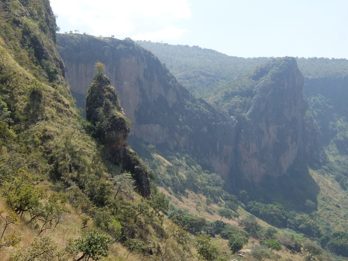
Approaching Mount Hanang, trekkers are greeted by a towering stratovolcano rising sharply above the Hanang plains. The ascent reveals a dramatic transition from lush montane forests to rocky ridges and alpine heathland. The climb challenges the body with steep inclines and high altitude, but rewards with sweeping views of the Great Rift Valley, Lake Balangida, and the surrounding villages. The contrast between the dense greenery of the forest reserve and the barren volcanic summit creates a powerful sense of geological grandeur. Reaching the crater rim, hikers experience a profound connection to the mountain’s ancient volcanic past and the vibrant cultures of the Barbaig and Iraqw peoples who revere this peak.
The Volcano Itself: Geological Background
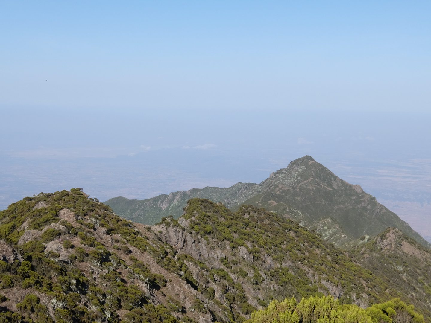
Mount Hanang is a dormant stratovolcano located in Tanzania’s Manyara Region, standing at 3,420 meters above sea level. It formed millions of years ago as part of the East African Rift system, a tectonic boundary that created a series of volcanic peaks and valleys. The volcano’s structure features steep slopes composed of volcanic rock, with a horseshoe-shaped ridge that encloses an ancient crater valley. Its last eruption occurred during the Pleistocene epoch, leaving behind a landscape shaped by lava flows, rocky outcrops, and eroded volcanic deposits. The mountain’s geology supports a rich variety of volcanic minerals and soils that sustain montane forests and heathlands. Fumaroles and active volcanic gases are absent today, but the mountain’s volcanic origins remain evident in its rugged terrain and striking ridgelines.
The Volcano Trek: Terrain and Hiking Experience
The trek up Mount Hanang is a physically demanding journey marked by steep elevation gains and diverse terrain. Starting from the town of Katesh, the most popular route ascends approximately 1,600 meters over 8.5 kilometers. The initial sections wind through dense montane forests, where hikers encounter thick vegetation, moss-covered trees, and a rich birdlife including endemic species. As the trail climbs higher, the forest gives way to bushland and grasslands, with increasingly rocky and uneven ground. Trekkers must navigate loose volcanic rocks and boulders, requiring sure-footedness and concentration, especially on the steeper slopes. The trail includes sections of stone steps constructed to ease the ascent, but the incline remains relentless. Weather conditions can vary dramatically; warm sun at lower elevations can quickly shift to cold winds and near-freezing temperatures at the summit. Camping at the high-altitude site near 3,100 meters is common, exposing hikers to chilly nights and thin air. The descent demands careful footing on rocky scree and can be taxing on knees and ankles. Despite the challenges, the trek offers spectacular panoramic views of the Great Rift Valley, soda lakes, and the surrounding highlands, making the effort deeply rewarding for experienced and fit hikers.

What Makes This Volcano Trek Unique
Mount Hanang stands out for its remote location and the blend of natural and cultural experiences it offers. Unlike Tanzania’s more famous peaks, Hanang sees fewer visitors, providing a tranquil and authentic trekking environment. The mountain’s steep volcanic slopes rise sharply from the surrounding plains, creating dramatic vistas of the Great Rift Valley and nearby soda lakes. The trek is enriched by encounters with the Barbaig and Iraqw communities, whose traditional pastoralist and agricultural lifestyles add a unique cultural dimension. Sacred sites and rituals linked to the mountain’s spiritual significance deepen the connection between nature and local heritage. Ecologically, the mountain supports diverse habitats from evergreen montane forests to alpine heathlands, home to rare wildlife such as klipspringers, bushbucks, and endemic mole-rats. The combination of challenging terrain, rich biodiversity, and cultural immersion makes Mount Hanang a distinctive volcano trekking destination.
The Summit and Crater Experience
Reaching the summit of Mount Hanang is a moment of triumph and awe. The crater rim offers expansive views stretching across the Great Rift Valley, with the patchwork of villages, soda lakes, and distant mountain ranges visible on clear days. The air is thin and crisp, carrying the scent of alpine grasses and earth. Though the volcano is dormant, the rugged volcanic landscape around the summit reveals its fiery origins through jagged rock formations and ancient lava flows. The silence at the top is profound, broken only by the wind and distant bird calls. Hikers often pause to absorb the vastness of the panorama and the sense of standing atop a geological giant. The experience is heightened by the knowledge of the mountain’s cultural significance to local tribes, who regard the summit as a sacred place.

Best Time to Trek Mount Hanang
The optimal time to trek Mount Hanang is during the dry season, which runs from early May through March, with June to October being particularly favorable. During these months, trails are less muddy and weather conditions are more stable, reducing the risk of slippery terrain and flash floods. Temperatures are generally moderate, though nights at higher elevations can be cold. The rainy season, typically from March to May, brings heavy showers that can make the steep slopes hazardous and increase the risk of mudslides. Climbers should also consider the timing of their trek to avoid the hottest midday sun, especially on exposed sections of the trail. Early morning starts are recommended to maximize daylight and enjoy cooler temperatures. Monitoring local weather forecasts and consulting with guides ensures a safe and enjoyable trekking window.
Trekking Routes and Trail Options on Mount Hanang
Mount Hanang offers several established trekking routes, each providing distinct experiences. The most popular and shortest is the Katesh Route, starting from the town of Katesh on the southwestern side. This trail covers approximately 8.5 kilometers to the summit with an elevation gain of 1,600 meters. It is favored for its directness and accessibility, typically completed in one long day or as a two-day trek with an overnight camp at around 3,100 meters. The trail features steep inclines, rocky terrain, and constructed stone steps to aid ascent.
The Gendabi Route approaches from the northwestern side, beginning at Gendabi village. This path is renowned for its scenic beauty, passing through diverse vegetation zones and offering panoramic views of the surrounding landscape. It is less frequented, providing a more secluded trekking experience.
The Giting Route starts from Giting village on the northeastern flank. This route is more remote and rugged, suitable for experienced hikers seeking wildlife viewing opportunities and cultural encounters. Access to this trail may require a 4WD vehicle due to poor road conditions.
All routes require permits from the Mount Hanang Nature Forest Reserve authorities, and hiring local guides is recommended for safety and cultural insight. Trekkers can choose between guided and self-guided options, though local expertise enhances the experience and navigation.
Difficulty Assessment of Mount Hanang Trek
Mount Hanang is classified as a moderate to demanding volcano trek. The primary challenge lies in the steep elevation gain of approximately 1,600 meters over a relatively short distance, which tests cardiovascular endurance and leg strength. The terrain is rocky and uneven, requiring sure-footedness and careful footing, especially on loose scree and boulder sections. Altitude effects become noticeable above 3,000 meters, with thinner air causing shortness of breath and fatigue for some hikers.
The trek does not require technical climbing skills or specialized equipment, making it accessible to fit hikers with prior trekking experience. However, the rapid elevation gain and exposure to variable weather conditions, including cold nights and strong winds at higher altitudes, add to the difficulty. Proper acclimatization and physical preparation are recommended. Overall, Mount Hanang offers a challenging but achievable ascent for adventurous trekkers seeking a less crowded alternative to Tanzania’s more famous peaks.
Essential Volcano Trekking Gear for Mount Hanang
Successful trekking on Mount Hanang requires gear suited to steep, rocky terrain and variable weather. Essential items include sturdy hiking boots with good ankle support and grip to navigate loose volcanic rocks and uneven paths. Trekking poles are highly recommended to aid balance and reduce strain on knees during ascent and descent. Layered clothing is necessary to adapt to temperature changes, including moisture-wicking base layers, insulating mid-layers, and a windproof, waterproof outer shell.
A warm hat, gloves, and thermal socks are important for cold nights at the campsite near the summit. A headlamp is useful for early starts or late finishes. Sun protection, including a wide-brimmed hat, sunglasses, and high-SPF sunscreen, is vital due to high altitude exposure. Carry sufficient water and a hydration system to stay well-hydrated. A basic first aid kit, including blister treatment and altitude sickness medication, is advisable. For those sensitive to dust or volcanic ash, a lightweight face mask or buff can provide protection. Finally, a durable backpack to carry gear and food completes the essential kit for a safe and comfortable Mount Hanang trek.
Safety and Volcanic Hazards on Mount Hanang
Mount Hanang is a dormant volcano with no recent eruptive activity, minimizing volcanic hazards such as lava flows or gas emissions. However, trekkers should remain vigilant about natural risks associated with mountainous terrain. Steep slopes and loose volcanic rocks increase the risk of slips and falls, particularly during wet conditions. Sudden weather changes can bring cold temperatures, strong winds, and reduced visibility, requiring appropriate gear and caution.
Recent flash floods and mudslides have occurred in the region, emphasizing the importance of monitoring weather forecasts and avoiding trekking during heavy rains. Local guides provide valuable knowledge of safe routes and current trail conditions. The Tanzania Forest Services Agency manages the Mount Hanang Nature Forest Reserve and issues permits, also providing safety information.
Altitude sickness is a potential concern due to rapid elevation gain; climbers should acclimatize properly and recognize symptoms such as headache, nausea, and dizziness. Emergency evacuation options are limited, so preparedness and communication plans are essential. Overall, adherence to safety guidelines, use of experienced guides, and respect for the mountain environment ensure a secure trekking experience.
Permits, Guides, and Logistics for Mount Hanang Trekking
Trekking Mount Hanang requires obtaining permits from the Tanzania Forest Services (TFS) Agency, which manages the Mount Hanang Nature Forest Reserve. Permits are mandatory for entry and help support conservation efforts. Visitors can secure permits through local offices in Katesh or Babati, or via tour operators who handle the process as part of their packages. Permit fees vary but are generally affordable, contributing to reserve maintenance and community development.
Hiring a local guide is strongly recommended for safety, navigation, and cultural interpretation. Experienced guides are familiar with the terrain, weather patterns, and local customs, enhancing the trekking experience. Several reputable tour operators offer organized Mount Hanang treks, including Kili Tanzanite Safaris, Congema Safaris, Ifude Tours & Safaris, and Altezza Travel. These companies provide comprehensive services such as transportation from Arusha or Kilimanjaro Airport, camping equipment, meals, and porters.
Logistically, the main trailhead is in Katesh town, accessible by road from Arusha (approximately 3-4 hours) or Babati. Treks can be arranged as day hikes or two-day excursions with overnight camping on the mountain. Accommodation options in Katesh and Babati include hotels and guesthouses for pre- and post-trek stays. Climbers should plan for early starts to maximize daylight and consider weather conditions when scheduling. Booking through established operators ensures smooth logistics, permit handling, and local community support.
Where to Stay and Nearby Bases for Mount Hanang Treks
Accommodation options near Mount Hanang are primarily located in the towns of Katesh and Babati, serving as convenient bases for trekkers. Katesh, situated at the mountain’s southwestern foot, offers modest hotels and guesthouses such as The Summit Hotel, which provides basic but comfortable rooms with essential amenities including private showers and toilets. Staying in Katesh allows early access to the main trailhead and facilitates permit acquisition.
Babati, the administrative center of Manyara Region located about 60 kilometers from Katesh, features a wider range of lodging options, including mid-range hotels and guesthouses with better facilities. Babati’s larger size offers more dining and shopping choices, making it suitable for pre- or post-trek stays.
For the trek itself, camping is the standard accommodation on Mount Hanang. The mountain reserve maintains designated campsites near 3,100 meters elevation, equipped with basic facilities. Trekkers typically use alpine tents provided by tour operators, who also supply meals and camping gear. Camping at altitude exposes hikers to cold temperatures and requires appropriate sleeping bags and clothing.
Some local homestays and community-run accommodations exist in villages like Gendabi and Giting along alternative routes, offering cultural immersion but limited amenities. Booking through reputable tour operators ensures access to quality camping equipment and reliable local support. Overall, combining town-based lodging with mountain camping provides a balanced and immersive trekking experience.