
Mount Tambora Volcano Trekking Guide: Conquer Indonesia’s Historic Giant Caldera
Explore the demanding yet rewarding trek to Mount Tambora, Indonesia’s stratovolcano famed for the largest historic eruption in 1815. Discover detailed routes, geological insights, trekking challenges, and practical logistics for an unforgettable volcano adventure on Sumbawa Island.
Quick Volcano Snapshot
| Attribute | Value |
|---|---|
| Volcano type | Stratovolcano |
| Elevation | 2,851 meters |
| Location | Sumbawa Island, West Nusa Tenggara, Indonesia |
| Activity status | Active |
| Trekking difficulty | Demanding |
| Typical trek duration | 2 to 4 days |
| Altitude gain | Approximately 1,500 meters |
| Terrain type | Volcanic ash slopes, savanna, jungle, rocky crater rim |
| Best season | April to October (dry season) |
| Temperature range | 7°C to 25°C |
| Permit requirement | Required – permits issued by Tambora National Park Office |
The Experience of Hiking Mount Tambora
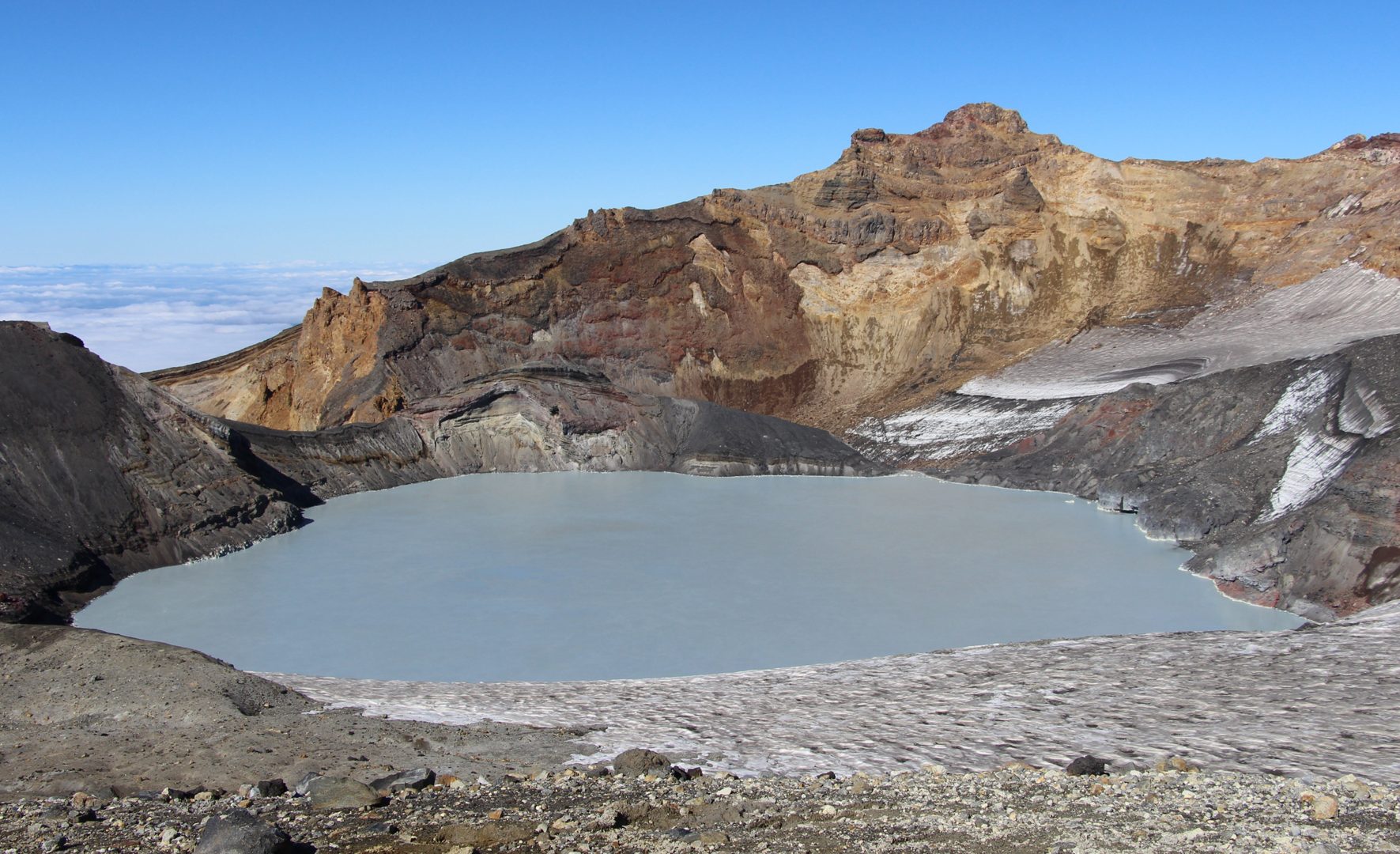
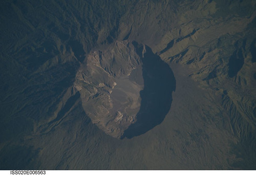
Approaching Mount Tambora, trekkers enter a landscape shaped by one of history’s most powerful volcanic eruptions. The vast caldera and rugged summit evoke a profound sense of geological power and isolation. The trail leads through contrasting environments: from dense tropical rainforest to open savanna and finally to barren volcanic ash slopes. The silence atop the crater rim, punctuated only by the wind and distant bird calls, offers a humbling encounter with nature’s raw forces. Reaching the summit, the immense caldera stretches before you, a reminder of the mountain’s explosive past and enduring presence.
Geological Background of Mount Tambora
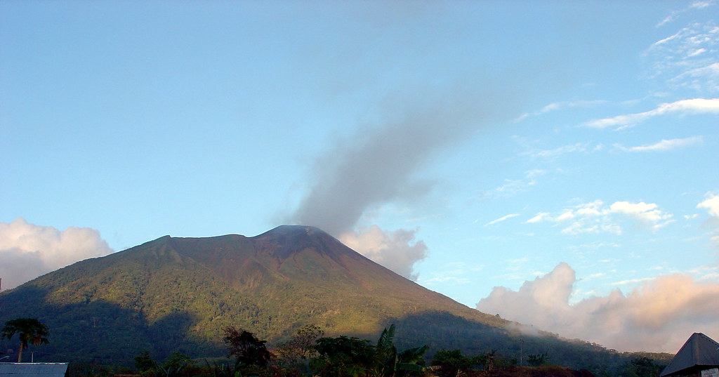
Mount Tambora is a stratovolcano located on Sumbawa Island in Indonesia, renowned for its colossal eruption in April 1815, the largest volcanic explosion in recorded history. Before the eruption, Tambora’s summit reached over 4,000 meters, but the event reduced it to approximately 2,851 meters today. The eruption expelled around 160 cubic kilometers of volcanic material, creating a caldera over 7 kilometers wide and more than 1,000 meters deep. This VEI 7 eruption drastically altered global climate, causing the “Year Without a Summer” in 1816. The volcano’s geology features thick layers of ash and pumice, extensive lava flows, and fumaroles emitting sulfurous gases. The caldera rim exposes unique volcanic minerals and formations, offering a vivid geological record of the eruption and subsequent volcanic activity.
Terrain and Hiking Experience on Mount Tambora
Trekking Mount Tambora is a demanding adventure that challenges hikers with diverse terrain and significant altitude gain. The journey begins in tropical rainforest at the mountain’s base, where humidity and heat can be intense. As you ascend, the trail transitions into open savanna grasslands, known locally as Doro Ncanga, characterized by golden grasses and sparse shade. This section exposes trekkers to direct sun and wind, requiring sun protection and hydration. Beyond the savanna, the terrain shifts to volcanic ash slopes and loose pumice, demanding careful footing and steady pace to navigate steep, slippery inclines. The trail includes rocky sections near the crater rim, where volcanic debris and unstable ground require caution. Altitude effects become noticeable above 2,000 meters, with cooler temperatures and thinner air. Wind conditions at the summit can be strong, adding to the physical challenge. Despite these difficulties, the trail is well-marked and maintained, with several rest posts and water sources along the way. Campers often stay at designated positions such as Pos 3 or Pos 5, where flat areas allow tent setup. The hiking experience combines physical exertion with stunning views of the caldera, surrounding savanna, and distant ocean. The trail’s variety—from dense jungle to barren volcanic desert—offers a unique sensory journey through contrasting ecosystems shaped by volcanic forces.

What Makes the Mount Tambora Trek Unique
Mount Tambora’s trek stands apart due to its historical significance and dramatic volcanic landscape. It is the site of the largest historic eruption, which reshaped global climate and human history. The immense caldera, over 7 kilometers wide, is one of the largest in the world and offers unparalleled panoramic views. Unlike more frequented Indonesian volcanoes, Tambora remains remote and less crowded, providing solitude and a genuine wilderness experience. The trek traverses diverse ecosystems, from tropical rainforest to volcanic savanna and ash deserts, showcasing rich biodiversity including rare bird species. Cultural encounters with local villages add depth, revealing traditional lifestyles shaped by the mountain’s presence. The opportunity to camp near the crater rim and witness sunrise over the vast caldera is a rare and unforgettable experience for volcano enthusiasts.
Summit and Crater Experience on Mount Tambora
Reaching Mount Tambora’s summit is a moment of awe and reflection. The crater rim reveals a vast caldera, a silent monument to the 1815 eruption’s power. The air is crisp and cool, carrying the faint scent of sulfur from fumaroles below. The rim’s edge offers sweeping views of the surrounding savanna, distant ocean, and neighboring islands. The ground beneath is a mosaic of volcanic ash, pumice, and jagged rocks, with occasional steam vents adding to the otherworldly atmosphere. The silence is profound, broken only by the wind and the occasional call of birds. Watching the sunrise from the crater rim bathes the landscape in golden light, highlighting the caldera’s scale and the mountain’s rugged beauty. This sensory experience connects trekkers deeply with the earth’s dynamic forces and the mountain’s dramatic history.
Best Time to Trek Mount Tambora
The optimal trekking season for Mount Tambora is during the dry months from April to October. During this period, trails are more accessible, and weather conditions are generally stable with clear skies. The dry season reduces the risk of slippery paths and heavy rains that can make the ascent hazardous. Temperatures range from mild to cool, especially at higher elevations, with nighttime lows around 7°C near the crater rim. The rainy season, from December to April, brings frequent showers, muddy trails, and increased risk of landslides, and the national park often closes during this time for safety and ecological recovery. Trekkers should also consider starting early morning hikes to avoid midday heat and to experience sunrise views at the summit. Monitoring volcanic activity and park announcements is essential, as temporary closures may occur for safety reasons.
Trekking Routes and Trail Options on Mount Tambora
Mount Tambora offers four official trekking routes, each with distinct characteristics and challenges. The Pancasila Route, located in Dompu Regency, is the most popular and demanding path, taking approximately three days and two nights. It passes through dense tropical forest, coffee plantations, and five resting posts before reaching the crater rim. This route includes the mountain’s highest peak, unique to this trail. The Doro Ncanga Route is accessible by 4WD vehicles up to Pos 3, followed by a two-hour hike to the summit. It traverses open savanna and volcanic terrain and is typically completed in two days. The Oi Marai Route, starting in Kawinda Toi Village, offers a three-day trek with scenic waterfalls and recreational activities like rafting near the trail. The Piong Route is the easiest and shortest, allowing hikers to reach the summit in one day from the southern side, with off-road vehicle access to Pos 5. Guided tours are available for all routes, providing logistical support, porters, and camping equipment. Each trail offers unique views and experiences, catering to different fitness levels and time constraints.
Difficulty Assessment of Mount Tambora Trek
Mount Tambora’s trek is classified as demanding but non-technical. The trail requires good physical fitness due to steep ascents, loose volcanic ash, and significant altitude gain of approximately 1,500 meters. Hikers should be prepared for long days of trekking, uneven terrain, and variable weather conditions. While no technical climbing skills are necessary, careful footing is essential on slippery ash slopes and rocky sections near the crater rim. Altitude effects may cause mild discomfort for some trekkers. The trail is well-marked and maintained, with resting posts and water sources, but the remote location demands self-sufficiency and preparation. Overall, the trek suits experienced hikers comfortable with multi-day mountain expeditions and capable of handling physical challenges in a tropical volcanic environment.
Essential Gear for Trekking Mount Tambora
Proper gear is crucial for a safe and comfortable Mount Tambora trek. Recommended items include sturdy hiking boots with good grip for volcanic ash and rocky terrain, trekking poles to aid balance on loose slopes, and gaiters to protect against ash and debris. Layered clothing is advised to adapt to temperature changes, including moisture-wicking base layers, insulating mid-layers, and a windproof, waterproof jacket. Sun protection is vital due to exposed savanna sections—bring a wide-brimmed hat, sunglasses, and high-SPF sunscreen. A headlamp is necessary for early morning summit ascents. Hydration systems or water bottles with purification methods are essential, as water sources are limited. A gas mask or respirator is generally not required but may be useful if fumarole gases are strong. Additional items include a backpack with rain cover, camping gear if staying overnight, insect repellent, and a first aid kit.
Safety and Volcanic Hazards on Mount Tambora
While Mount Tambora is currently active but stable, trekkers must remain vigilant about volcanic hazards. The 1815 eruption’s legacy includes unstable crater edges and loose volcanic debris that can pose risks of falls or rockslides. Fumaroles near the crater emit sulfurous gases, which can be irritating; hikers with respiratory issues should take precautions. Sudden weather changes, including strong winds and rain, can increase trail difficulty and risk hypothermia at higher elevations. Monitoring by the Tambora National Park Office and Indonesian volcanic agencies is ongoing, and temporary trail closures may be enforced for safety. Visitors should adhere strictly to park regulations, stay on marked trails, and avoid restricted areas. Guides provide essential safety briefings and emergency protocols. Carrying a communication device and traveling in groups enhances safety in this remote environment.
Permits, Guides, and Logistics for Mount Tambora Trekking
Mount Tambora trekking requires permits issued by the Tambora National Park Office, which manages access to the protected area. Visitors must register and pay entrance fees, typically included in guided tour packages. Due to the mountain’s remote location and challenging logistics, hiring professional guides and porters is strongly recommended. Several reputable tour operators specialize in Mount Tambora expeditions, including Climb Indonesia, Sumbawa Adventour, Explore Tambora, Visit Tambora, and Jeweh Rinjani. These companies offer comprehensive packages covering permits, transportation, accommodation, meals, camping equipment, and experienced guides. Most treks start from villages such as Pancasila or Doro Ncanga, accessible via Bima city, the main gateway reached by domestic flights from Bali or Lombok. Transport from Bima to trailheads requires advance arrangement, as public options are limited. Guided tours typically include airport pickup, 4WD transfers, and multi-day trekking itineraries ranging from two to four days. Booking well in advance is essential due to limited infrastructure and seasonal closures. The park may close trails temporarily for ecological recovery or safety, so checking current conditions before planning is crucial.
Where to Stay and Nearby Bases for Mount Tambora Treks
Accommodation options near Mount Tambora are modest but sufficient for trekking needs. The main gateway towns of Bima and Dompu offer basic hotels and guesthouses such as Hotel Sinar Tambora and Hotel Irma, providing comfortable stays with amenities like internet access, laundry, and dining. For a more immersive experience, homestays in villages like Pancasila and Doro Ncanga offer local hospitality and proximity to trailheads. Camping is permitted within the national park at designated posts, including Pos 3 and Pos 5, where flat areas allow tent setup. For travelers seeking comfort blended with nature, Visit Tambora operates a hilltop glamping site nestled within a coffee plantation at about 700 meters elevation. This site features three canvas tents with private bathrooms, cold showers, solar lighting, and panoramic views of Mount Tambora and Satonda Island. The glamping experience balances rustic adventure with essential comforts, ideal for small groups or couples. Due to limited tourism infrastructure, booking accommodations and guides well in advance is advised, especially during the dry season. Transportation from Bima to trailheads typically involves 4WD vehicles or motorbikes, arranged by tour operators or local contacts.