
Mount Talang Volcano Trekking Guide: Exploring West Sumatra’s Active Stratovolcano with Twin Crater Lakes
Mount Talang, an active stratovolcano in West Sumatra, Indonesia, offers a moderate yet rewarding trekking experience. Known for its twin crater lakes, lush forests, and volcanic landscapes, it is accessible via two main routes and features unique geological formations and rich biodiversity.
Quick Volcano Snapshot
| Attribute | Value |
|---|---|
| Volcano type | Stratovolcano |
| Elevation | 2,597 m (8,520 ft) |
| Location | West Sumatra, Indonesia |
| Activity status | Active |
| Trekking difficulty | Moderate |
| Typical trek duration | 4 to 6 hours to summit |
| Altitude gain | Approximately 1,100 m |
| Terrain type | Volcanic ash slopes, jungle trails, farmland, rocky ridges |
| Best season | Dry season (May to September) |
| Temperature range | 10°C to 25°C |
| Permit requirement | Required, obtainable at trailhead or via local guides |
Introduction: The Experience of Hiking Mount Talang
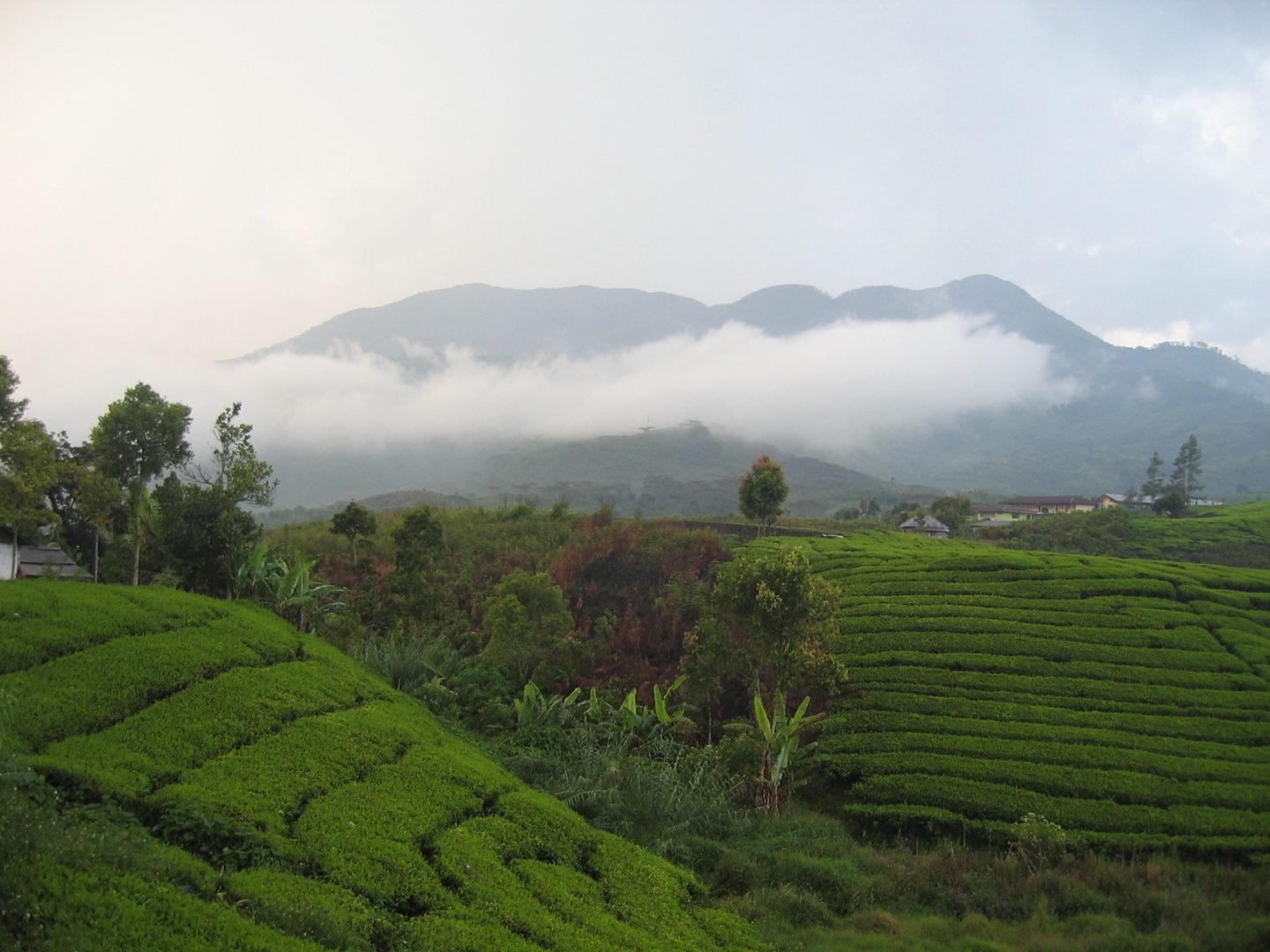
Approaching Mount Talang, trekkers are greeted by a dramatic volcanic silhouette rising above lush tea plantations and dense tropical forests. The trail weaves through vibrant farmland and jungle, contrasting with the stark volcanic terrain near the summit. The air carries a faint sulfur scent, hinting at the mountain’s active nature. As you ascend, the landscape opens to breathtaking views of twin crater lakes nestled on the volcano’s flanks. Reaching the summit offers a profound sense of connection to the Earth’s raw power, with steaming fumaroles and burnt forests telling stories of past eruptions. The climb is both a physical challenge and a journey through a dynamic geological masterpiece.
Geological Background of Mount Talang
Mount Talang is an active stratovolcano located in West Sumatra, Indonesia, standing at 2,597 meters above sea level. Formed by successive layers of lava flows, ash, and volcanic debris, it is part of the Pacific Ring of Fire, a region known for intense seismic and volcanic activity. The volcano features two prominent crater lakes on its flanks, with Lake Talang being the larger, measuring approximately 1 by 2 kilometers. Historical records confirm at least eight eruptions between 1833 and 1968, with a notable minor eruption in 2005 linked to the 2004 Indian Ocean earthquake. The summit area still bears scars from past eruptions, including burnt forests and fumarolic activity. Unique geological features include sulfur fumaroles, steam vents, and deposits of volcanic minerals. The mountain’s upper slopes are home to endemic species such as the pitcher plant Nepenthes talangensis, highlighting its ecological significance.
The Volcano Trek: Terrain and Hiking Experience
Trekking Mount Talang offers a diverse and engaging hiking experience through varying terrain types. The most popular route begins at Air Batumbuk village, starting at around 1,465 meters elevation. Initially, hikers traverse farmland and tea plantations, where the trail is wide and well-defined, providing a gentle introduction to the ascent. As the trail progresses, it enters dense tropical jungle, characterized by thick vegetation and occasional muddy patches. The jungle section can be slippery, especially after rain, with deep puddles and occasional leeches, requiring careful footing and waterproof footwear. Beyond the forest, the terrain becomes steeper and more rugged, transitioning to volcanic ash slopes and rocky ridges. The volcanic soil is loose in places, demanding steady balance and moderate scrambling skills. Near the summit, hikers encounter active fumaroles emitting sulfurous gases, and the landscape is marked by burnt trees from previous eruptions, creating a haunting yet fascinating atmosphere. The trail culminates at a large flat camping area below the summit cliffs, where hikers can rest before the final push to the peak. The summit offers panoramic views of the surrounding Barisan mountain range and the twin crater lakes below. Weather conditions can vary rapidly, with cooler temperatures and strong winds near the top, so layered clothing is essential. Overall, the trek combines moderate physical challenge with rich natural and geological diversity, making it suitable for both novice and experienced hikers prepared for tropical mountain conditions.
What Makes the Mount Talang Trek Unique
Mount Talang stands out for its twin crater lakes, a rare feature that adds spectacular scenic value to the trek. These volcanic lakes, Lake Talang and its smaller counterpart, are nestled on the volcano’s flanks and provide stunning photographic opportunities. The presence of active fumaroles near the summit adds a dynamic element, with visible steam vents and sulfur deposits illustrating the volcano’s ongoing activity. The trek also passes through the ‘Dead Forest’ area, where trees scorched by past eruptions create an eerie yet captivating landscape. Rich biodiversity, including endemic plants like the Nepenthes talangensis pitcher plant and abundant birdlife and monkeys, enriches the hiking experience. The cultural significance of the mountain to local communities adds depth to the journey, with spiritual beliefs intertwined with the natural environment. The accessibility of Mount Talang, being just a three-hour drive from Padang, makes it a favored weekend destination for local students and adventurers, blending convenience with adventure.
The Summit and Crater Experience
Reaching the summit of Mount Talang is a moment of awe and reflection. The crater rim reveals a rugged volcanic landscape marked by fumaroles emitting sulfurous steam, filling the air with a distinctive, sharp scent. The ground beneath is warm in places, a reminder of the volcano’s active nature. From the peak, panoramic views stretch across the Barisan mountain range, with clear sights of the twin crater lakes below, shimmering in the sunlight. The burnt trees of the ‘Dead Forest’ add a dramatic foreground to the vista. The summit’s exposure to wind and cooler temperatures contrasts with the humid jungle below, creating a refreshing atmosphere. The soundscape includes the subtle hiss of escaping gases and the occasional call of distant wildlife. This sensory immersion into the volcano’s power and beauty leaves a lasting impression on trekkers.
Best Time to Trek Mount Talang
The optimal time to trek Mount Talang is during the dry season, from May to September, when trails are less muddy and weather conditions are more stable. During this period, rainfall is minimal, reducing the risk of slippery paths and leech encounters. Early morning starts are recommended to avoid afternoon heat and potential thunderstorms common in tropical climates. Trekking outside the dry season can be challenging due to heavy rains, muddy trails, and increased leech activity. Additionally, volcanic activity is monitored by local authorities, and climbers should check for any alerts or restrictions before planning their trip. The mountain’s moderate altitude means temperatures can drop significantly near the summit, especially at night, so appropriate warm clothing is essential for early morning or overnight climbs.
Trekking Routes and Trail Options on Mount Talang
Mount Talang offers two primary trekking routes, each providing distinct experiences. The most popular and accessible route begins at Air Batumbuk village on the southern side. Starting at approximately 1,465 meters, this trail leads through farmland and tea plantations before entering dense tropical forest. The trail is well-marked and frequented by local hikers, making it suitable for beginners and those seeking a moderate challenge. Along the way, hikers can camp at Pesanggrahan (1,510 m) or the main campsite at 2,195 meters, which is a sheltered flat area near active fumaroles. From the campsite, the summit is less than two hours away. The second route starts from Batu Bajanjang village near Bukit Sileh on the northeast side. This trail is less traveled and more challenging, beginning at around 1,371 meters. It features steeper inclines, rougher terrain, and a more remote atmosphere. The path passes through farmland, ridges with abundant monkey populations, and dense forest before reaching higher volcanic slopes. This route offers more solitude and dramatic views of the mountain’s imposing profile. Both routes require good physical fitness and preparation, with the southern trail favored for its accessibility and facilities, while the northeast route appeals to experienced trekkers seeking a more rugged adventure.
Difficulty Assessment of Mount Talang Trek
Mount Talang is classified as a moderate volcano trek. The ascent involves an altitude gain of approximately 1,100 meters over a relatively short distance, demanding a reasonable level of cardiovascular fitness. The terrain varies from wide, gentle paths through farmland to slippery jungle trails and steep volcanic ash slopes near the summit. Hikers should be prepared for muddy conditions, especially during or after rain, and occasional obstacles such as deep puddles and loose scree. While technical climbing skills are not required, good balance and surefootedness are essential. The presence of leeches in the forested sections may be a concern for some trekkers. Weather conditions can change rapidly, with cooler temperatures and strong winds at higher elevations. Overall, the trek is suitable for beginners with adequate preparation and for experienced hikers seeking a rewarding volcano climb without technical difficulties.
Essential Gear for Mount Talang Volcano Trekking
Proper gear is crucial for a safe and comfortable trek on Mount Talang. Recommended equipment includes sturdy hiking boots with good grip to handle slippery mud and loose volcanic ash. Trekking poles can aid balance on uneven terrain. Lightweight, breathable clothing with layers is advised to adapt to temperature changes, including a windproof jacket for summit winds. A headlamp or flashlight is essential for early morning starts or camping. Carry sufficient water and high-energy snacks to maintain hydration and energy levels. A first-aid kit should include supplies for minor injuries and leech bites. Due to sulfur fumes near fumaroles, sensitive individuals may consider a lightweight gas mask or respirator. Sun protection such as a hat, sunglasses, and sunscreen is important as the trail offers limited shade in volcanic areas. Waterproof gear or rain ponchos are recommended during the rainy season. Finally, a durable backpack to carry all essentials comfortably will enhance the trekking experience.
Safety and Volcanic Hazards on Mount Talang
Trekking Mount Talang involves inherent risks associated with active volcanoes and tropical mountain environments. Volcanic gases, particularly sulfur dioxide emitted from fumaroles near the summit, can cause respiratory irritation; hikers with asthma or respiratory conditions should exercise caution. The terrain includes unstable crater edges and loose volcanic ash slopes, increasing the risk of slips and falls. Falling rocks may occur, especially in steep sections. Sudden weather changes, including heavy rain and strong winds, can reduce visibility and trail safety. It is essential to monitor volcanic activity updates from local volcanology offices and heed any warnings or trail closures. Hikers should avoid venturing too close to fumaroles and respect marked safety zones. Carrying a first-aid kit and informing local authorities or guides of your itinerary enhances safety. Engaging experienced local guides familiar with the mountain’s conditions is strongly recommended to navigate hazards effectively.
Permits, Guides, and Logistics for Mount Talang Trekking
Climbing Mount Talang requires obtaining a permit, which can be arranged at the trailhead in Air Batumbuk or through local guides. Permits help regulate visitor numbers and ensure safety monitoring due to the volcano’s active status. The cost of permits is modest, typically affordable for individual trekkers and groups. Hiring a local guide is highly recommended for navigation, safety, and enriching the trekking experience with geological and cultural insights. Reputable tour operators offering guided trips include Climb Indonesia, Regina Adventure, and West Sumatra Guide. These companies provide comprehensive packages covering transportation, permits, accommodation, and guiding services. Access to the trailhead involves a three-hour drive from Padang city, with private drivers or arranged transfers commonly used. From the registration office, motorbike taxis (ojeks) can transport hikers closer to the trail start, reducing the initial approach hike. Accommodation options range from camping at designated sites on the mountain to hotels and homestays in nearby villages and Padang. It is advisable to book guides and transport in advance, especially during peak trekking seasons. Climbers should check volcanic activity reports and weather forecasts before departure to ensure safe conditions.
Where to Stay Near Mount Talang and Nearby Bases
Accommodation options for Mount Talang trekkers are available both near the trailheads and in the nearby city of Padang. For those seeking proximity to the mountain, homestays and guesthouses in Air Batumbuk village provide basic amenities and easy access to the southern trail. These local accommodations offer an authentic cultural experience and opportunities to arrange guides and permits. For more comfort and a wider range of services, Padang city, located approximately three hours by road, hosts numerous hotels catering to various budgets. Notable hotels include The ZHM Premiere Padang, known for modern, simply furnished rooms with free Wi-Fi; Hotel Santika Premiere Padang, featuring outdoor pools and restaurants; and Ibis Padang, offering minimalist-style rooms and spa facilities. Budget travelers may consider Amaris Hotel Padang or Oxville Hotel, both providing essential comforts and convenient locations. Bukittinggi, about a four-hour drive from Mount Talang, also offers accommodations such as Padi Ecolodge and Grand Rocky Hotel for those combining multiple volcano treks in West Sumatra. Many hotels provide transport arrangements to the mountain, and local tour operators can coordinate transfers, guiding, and lodging to ensure a seamless trekking experience.