
Mount Shasta Volcano Trekking Guide: Climb California’s Majestic Stratovolcano
Mount Shasta, a towering stratovolcano in Northern California, offers a demanding yet rewarding trekking experience. This guide covers its geology, hiking terrain, routes, permits, safety, and accommodation options for adventurers seeking to summit this iconic peak.
Quick Volcano Snapshot
| Attribute | Value |
|---|---|
| Volcano type | Stratovolcano |
| Elevation | 14,179 ft (4,322 m) |
| Location | Northern California, United States |
| Activity status | Dormant |
| Trekking difficulty | Demanding |
| Typical trek duration | 2-3 days |
| Altitude gain | 7,300 ft (2,225 m) |
| Terrain type | Snowfields, glaciers, volcanic rock, alpine terrain |
| Best season | Late spring to early summer (May to July) |
| Temperature range | Below freezing at summit to mild at base |
| Permit requirement | Wilderness Permit and Summit Pass required |
Introduction: The Experience of Hiking Mount Shasta
Approaching Mount Shasta, the sheer scale and snow-capped summit dominate the horizon, evoking a profound sense of awe. The landscape shifts from dense alpine forests to stark volcanic rock and glaciers as you ascend. The mountain’s dormant volcanic energy is palpable, a silent giant towering over Northern California. Reaching the summit offers an emotional climax: panoramic views stretching across the Cascades, the scent of crisp mountain air, and the humbling realization of standing atop one of the region’s most iconic peaks.
The Volcano Itself: Geological Background
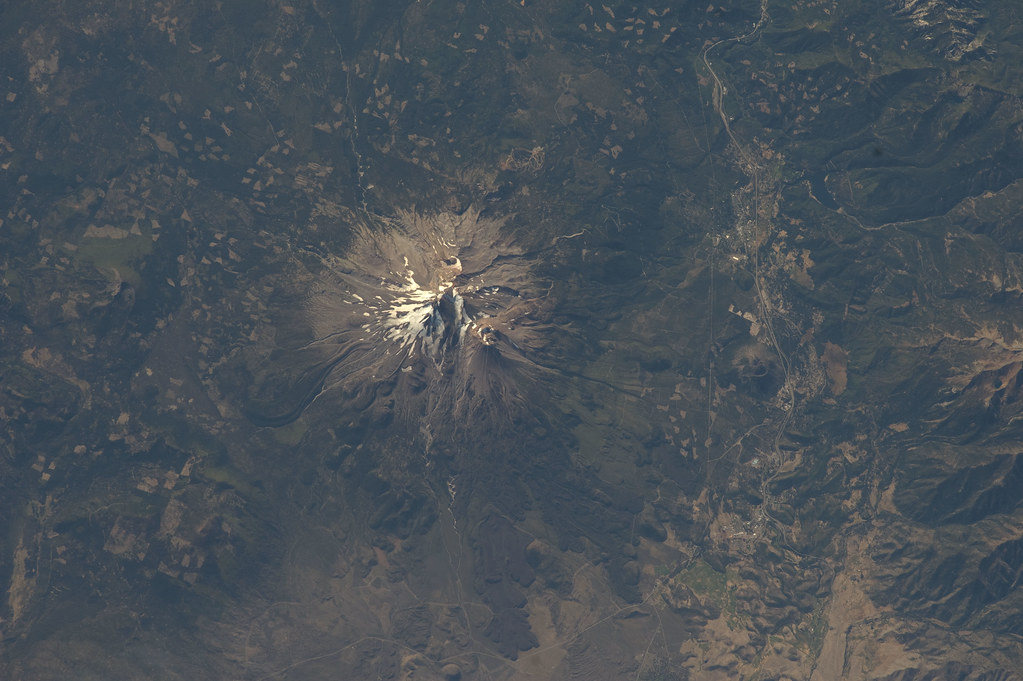
Mount Shasta is a massive stratovolcano formed by layers of hardened lava, tephra, and volcanic ash. It is the most voluminous stratovolcano in the Cascade Volcanic Arc, with an estimated volume of 85 cubic miles. The mountain consists of four overlapping volcanic cones, including the prominent satellite cone Shastina. Its formation dates back hundreds of thousands of years, shaped by repeated eruptions that built its complex structure. The volcano hosts seven named glaciers, including the Hotlum and Whitney glaciers, which are among California’s largest. Fumaroles and steam vents occasionally release volcanic gases, hinting at its potential activity despite its current dormant status. The mountain’s geology reveals a dynamic history of volcanic activity, glaciation, and erosion, creating a dramatic and varied landscape for trekkers.
The Volcano Trek: Terrain and Hiking Experience
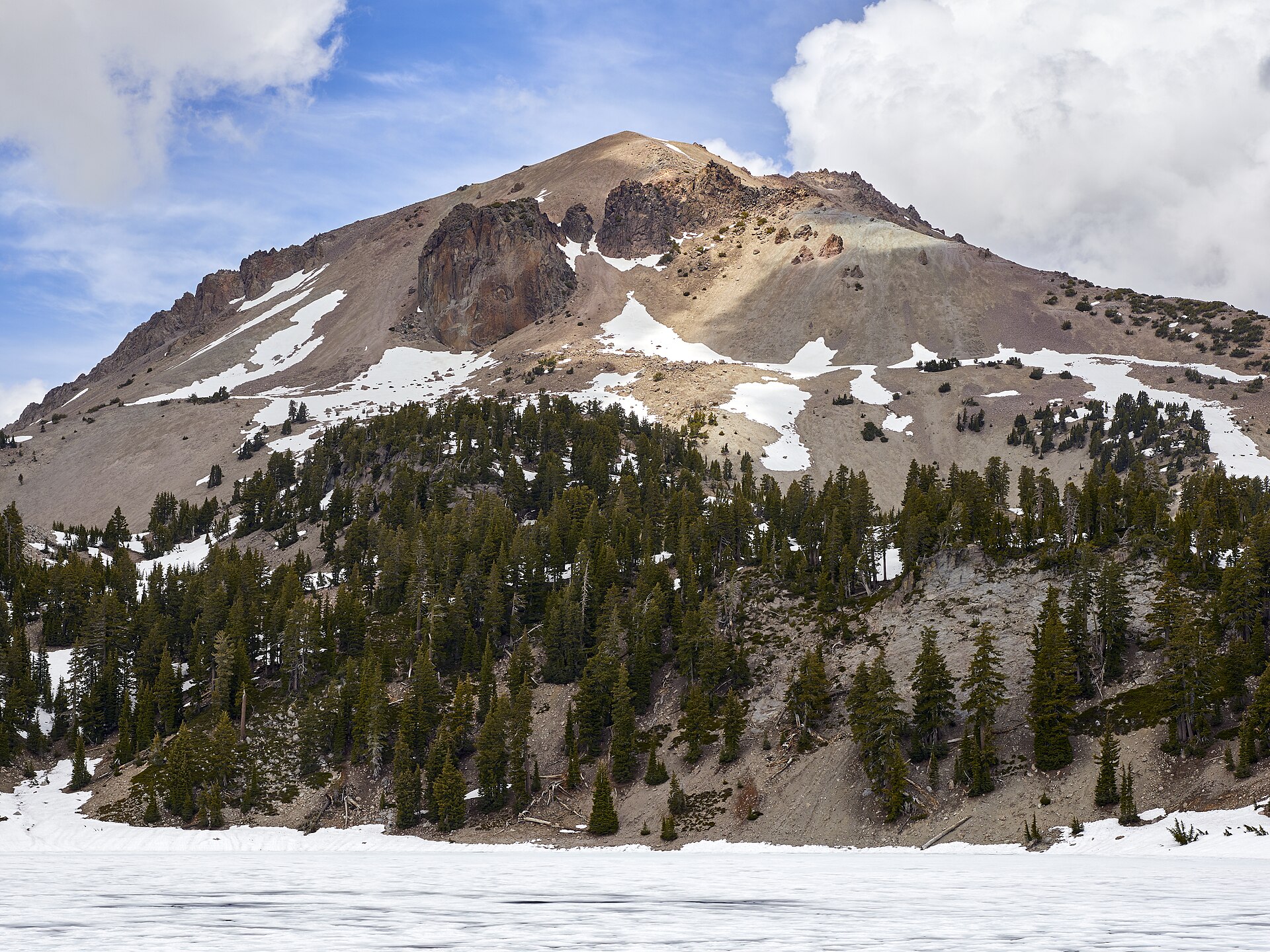
Climbing Mount Shasta is a demanding alpine adventure that challenges hikers with diverse and often rugged terrain. The trek typically begins at trailheads such as Bunny Flat on the southwestern flank, where dense fir forests provide initial shade and shelter. As you ascend, the forest thins, giving way to exposed volcanic rock, loose scree, and steep ash slopes. The terrain requires careful footing, especially on the upper mountain where glaciers and snowfields dominate. Routes like Avalanche Gulch funnel climbers through narrow gullies known for rockfall hazards, demanding vigilance and proper equipment such as crampons and ice axes.
The altitude gain of approximately 7,300 feet over 11 miles round-trip tests cardiovascular endurance and acclimatization. Climbers experience significant temperature shifts, from mild conditions at the base to freezing temperatures near the summit. Wind exposure increases with elevation, adding to the challenge. The volcanic rock can be sharp and unstable, requiring sturdy boots and trekking poles for balance. The presence of glaciers introduces technical elements, including snow climbing and potential crevasse navigation on less traveled routes.
Despite these challenges, the trail is well-marked and frequently traveled during the climbing season, with established campsites such as Helen Lake providing rest points. The switchbacks on the lower slopes help manage steep gradients, while the upper mountain demands sustained effort and focus. The combination of volcanic terrain, alpine conditions, and breathtaking vistas creates a uniquely rewarding hiking experience for prepared adventurers.

What Makes This Volcano Trek Unique
Mount Shasta stands out for its impressive volume and glaciated summit, a rare feature among Cascade volcanoes. Its towering snow-capped peak, visible from hundreds of miles away, offers a dramatic alpine environment with seven named glaciers. The mountain’s complex volcanic cones and extensive glacial valleys create a diverse landscape that blends volcanic power with icy wilderness. The spiritual significance of areas like Panther Meadows adds a mystical dimension to the trek. Climbers can experience a blend of volcanic geology, alpine climbing, and rich natural beauty, making Mount Shasta a singular destination for volcano enthusiasts.
The Summit and Crater Experience
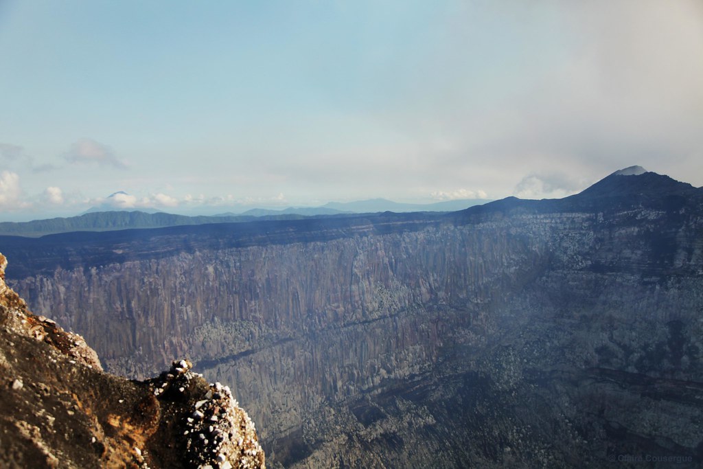
Reaching Mount Shasta’s summit is a moment of profound triumph and awe. The panoramic views encompass the Cascade Range, distant peaks, and vast wilderness below. The summit area is often windy and cold, with snowfields and rocky outcrops underfoot. Though the volcano is dormant, the presence of fumaroles and the scent of alpine air remind climbers of the mountain’s volcanic origins. The crater itself is broad and eroded, lacking the active lava lakes seen on some volcanoes, but its vastness and geological features tell a story of immense volcanic forces. The experience is both humbling and exhilarating, a reward for the physical and mental challenges of the ascent.

Best Time to Trek Mount Shasta
The optimal climbing season for Mount Shasta is late spring through early summer, typically May to July. During this period, snow conditions are stable enough for safe glacier travel, and weather is generally more predictable. Early season climbs require technical snow skills and equipment, while later in the season, snowfields may recede, exposing more rock. Climbers should avoid winter months due to extreme cold, avalanche risk, and shorter daylight hours. Monitoring volcanic activity and weather forecasts is essential, as sudden storms or volcanic gas emissions can pose hazards. Summit passes and permits are more readily available during the climbing season, and guided trips are commonly scheduled in these months.
Trekking Routes and Trail Options
Mount Shasta offers several established routes catering to different skill levels and climbing preferences. The most popular and accessible is the Avalanche Gulch route, starting at Bunny Flat Trailhead. This route covers approximately 11 miles round-trip with a 7,300-foot elevation gain and typically takes 2-3 days. It involves forest hiking, steep volcanic slopes, and glacier travel, making it suitable for climbers with basic mountaineering skills.
The Casaval Ridge route is more technical and less frequented, requiring advanced climbing skills and experience with exposed ridges and rock scrambling. The West Side routes, including the Clear Creek and Old Ski Bowl routes, offer alternative approaches with varying difficulty and terrain.
Guided climbs are available through several local operators, providing equipment, instruction, and logistical support. Self-guided climbers must be well-prepared with navigation skills and knowledge of mountain hazards. Trailheads are accessible by road, with parking available at Bunny Flat and other starting points. Seasonal conditions can affect route accessibility, so checking current trail reports and weather is crucial before planning your ascent.

Difficulty Assessment
Mount Shasta is classified as a demanding volcano trek. The combination of high altitude, significant elevation gain, and mixed terrain requires good physical fitness and some mountaineering experience. Climbers must be prepared for steep ascents on loose volcanic rock, snowfields, and glacier travel, which may necessitate technical gear such as crampons and ice axes. Altitude sickness is a risk due to the summit’s elevation of over 14,000 feet, so proper acclimatization is essential. The trek is not recommended for beginners without guidance or training. Overall, it is a challenging but achievable climb for well-prepared adventurers.
Essential Volcano Trekking Gear
Key gear for climbing Mount Shasta includes sturdy hiking boots with crampon compatibility, crampons, and an ice axe for snow and glacier travel. Trekking poles help with balance on loose terrain. Layered clothing is vital to adapt to temperature changes, including a windproof and waterproof jacket. A helmet is recommended for rockfall protection, especially on steep gullies. Sun protection such as sunglasses, sunscreen, and a wide-brimmed hat is necessary due to high UV exposure. Headlamps are essential for early starts or summit attempts in low light. Hydration systems and high-energy food support endurance. A gas mask is generally not required, but knowledge of volcanic gas hazards is important. Navigation tools and a first aid kit complete the essential equipment list.
Safety and Volcanic Hazards
While Mount Shasta is currently dormant, climbers must remain vigilant about potential hazards. The mountain’s steep gullies, such as Avalanche Gulch, are prone to rockfall and icefall, posing significant risks. Loose volcanic scree can cause slips and falls, especially on descent. Sudden weather changes, including high winds and storms, can create dangerous conditions. Volcanic gases are generally minimal but can accumulate in low-lying areas; monitoring by the U.S. Forest Service and volcanic observatories helps ensure climber safety. Proper acclimatization reduces altitude sickness risk. Climbers should follow all regulations, carry communication devices, and consider guided climbs for enhanced safety.
Permits, Guides, and Logistics
Climbing Mount Shasta requires obtaining two key permits: a Wilderness Permit and a Summit Pass. The Wilderness Permit is mandatory for all individuals entering the Mount Shasta Wilderness and is available free of charge at self-issue stations located at trailheads and ranger stations, including the Mount Shasta and McCloud Ranger Stations and the Fifth Season Outdoor Store in Mount Shasta City. The Summit Pass is required for anyone climbing above 10,000 feet and costs $25 for a 3-day pass or $30 for an annual pass. These passes help manage visitor impact and support mountain conservation.
Group sizes are limited to 10 persons or fewer to reduce environmental impact and maintain wilderness quality. Human waste must be packed out using free waste bags provided at trailheads and ranger stations, and wood fires are prohibited above certain elevations due to scarce firewood.
Several reputable local guiding companies offer professionally led climbs, including Shasta Mountain Guides, Shasta Mountaineering School, International Alpine Guides, SWS Mountain Guides, and Blackbird Mountain Guides. These services provide technical gear, instruction, meals, and permit handling, enhancing safety and success rates. Guided climbs typically run from May through July, with options for beginner to advanced climbers.
Logistically, the nearest airports are Redding Regional Airport (about 60 miles south) and Rogue Valley International Medford Airport (about 90 miles north). The town of Mount Shasta serves as the primary gateway, offering access to trailheads, gear shops, and accommodations. Road access is via Interstate 5, with parking available at major trailheads like Bunny Flat. Climbers should plan for early starts, carry adequate supplies, and check current conditions and permit requirements before their trip.
Where to Stay Near Mount Shasta
Mount Shasta City is the primary base for climbers and visitors, offering a range of accommodations from boutique hotels to cozy inns. Notable options include Summit Lofts Boutique Hotel, Inn At Mount Shasta, Best Western Plus Tree House, Cold Creek Inn, and Strawberry Valley Inn. These establishments provide convenient access to gear shops like the Fifth Season Outdoor Store and local dining.
For families and those seeking a quieter setting, Lake Siskiyou offers scenic lodging such as Mount Shasta Resort, Mount Shasta Ranch Bed and Breakfast, and Lake Siskiyou Camp Resort. This area features recreational opportunities like boating and biking, with the lake’s alpine backdrop enhancing the experience.
Nearby towns including McCloud, Dunsmuir, and Weed also provide accommodations and amenities, often at more affordable rates. These towns are within a short drive of trailheads and offer additional dining and shopping options.
Amenities across these locations range from free Wi-Fi and breakfast services to pet-friendly rooms and easy parking. Many lodges cater to outdoor enthusiasts with shuttle services, gear storage, and local knowledge. Early booking is recommended during peak climbing season due to high demand. Overall, the Mount Shasta region offers diverse lodging choices to suit different preferences and budgets, all within convenient reach of the mountain’s trails.